Fort Trumbull in New London in New London County, Connecticut — The American Northeast (New England)
Magnetic Silencing
Building 109
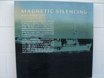
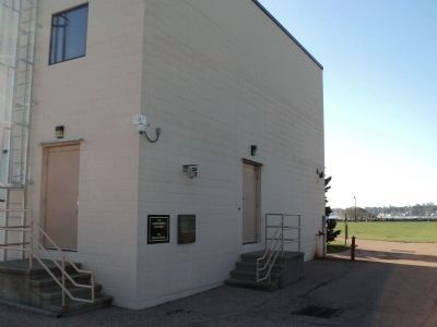
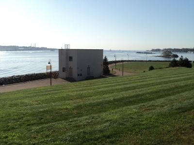
The navy uses the magnetic silencing range to determine if a ship may be vulnerable to detection by magnetic mines, which can blow a hole in a vessel and cause it to sink. The range consists of a series of devices installed underwater that measure the magnetic signatures of all submarines and surface ships entering and leaving New London Harbor. An operator in this building checks these measurements to see if a vessel is at risk of being detected by a mine.
The navy requires monitoring of all its vessels to make sure that their magnetic fields do not exceed safe limits. The navy base across the Thames River, in Groton, oversees this facility, which is the only one of its type in the Northeast and one of just nine in the entire world. It provides magnetic silencing services for the U.S. Navy, other government-owned ships, NATO members, and other friendly foreign nations.
Erected by Fort Trumbull State Park.
Topics. This historical marker is listed in these topic lists: Science & Medicine • Waterways & Vessels.
Location. 41° 20.587′ N, 72° 5.553′ W. Marker is in New London, Connecticut, in New London County. It is in Fort Trumbull. Marker can be reached from East Street, on the left when traveling south. Marker is at Fort Trumbull State Park. Touch for map. Marker is in this post office area: New London CT 06320, United States of America. Touch for directions.
Other nearby markers. At least 8 other markers are within walking distance of this marker. “The Arches” (within shouting distance of this marker); Periscope Test Facility (within shouting distance of this marker); Civil War (within shouting distance of this marker); Coast Guard (within shouting distance of this marker); Post Civil War to 1910 (within shouting distance of this marker); “Aim, Load, Fire” (within shouting distance of this marker); The Third System (about 300 feet away, measured in a direct line); Scientific Research (about 300 feet away). Touch for a list and map of all markers in New London.
More about this marker. The background of the marker shows ships at sea.
Also see . . . History of Fort Trumbull. Friends of Fort Trumbull. (Submitted on October 16, 2011, by Bill Coughlin of Woodland Park, New Jersey.)
Credits. This page was last revised on May 6, 2023. It was originally submitted on October 16, 2011, by Bill Coughlin of Woodland Park, New Jersey. This page has been viewed 987 times since then and 76 times this year. Photos: 1, 2, 3, 4. submitted on October 16, 2011, by Bill Coughlin of Woodland Park, New Jersey.


