Lowell in Middlesex County, Massachusetts — The American Northeast (New England)
"Francis’ Folly"
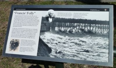
Engineer James B. Francis knew that the city of Lowell needed protection from floods. He studied the Merrimack River and understood the dangers of flooding introduced by the canals flowing through the city. The Guard Locks controlled the normal flow of water into the Pawtucket Canal, but Francis knew that the early dam could never contain the potential fury of a Merrimack swollen by melting snow and springtime torrents.
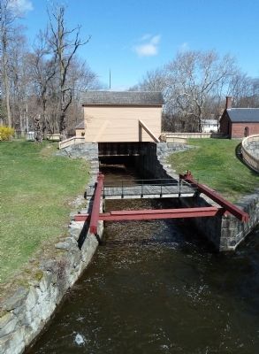
In 1850, he constructed the Great Gate, an extraordinary wooden structure measuring 25 feet by 27 feet and held up by an iron shackle. Critics called the massive floodgate "Francis’ Folly." Two years later, at 3:30 A.M. on April 22, 1852, workers used hammer and chisel to drop the gate before the rampaging river flooded downtown Lowell, thus "saving" the city.
Caption, large picture: The flood of 1936, seen here at the University Bridge, left most of Lowell’s downtown unscathed. This monumental event so affected young Jack Kerouac that he invoked it as a symbol for nature’s power in his novel Dr. Sax (1959).
Caption, small picture: In 1936, for the second time, workers (left) dropped the Great Gate. They cut the iron shackle and the massive 20-ton gate descended, shaking dishes in a cottage nearby.
Newspaper quotation, top right: The inhabitants of Lowell as well as the proprietors of the mills, have great cause to thank the gentleman (James B. Francis) who so promptly decided to take measures against what everyone considered a remote contingency, by what many considered a useless expenditure of money. Boston Daily Advertiser, April 28, 1852
Erected by Lowell National Historical Park and National Park Service, U.S. Department of the Interior.
Topics. This historical marker is listed in these topic lists: Charity & Public Work • Settlements & Settlers • Waterways & Vessels. A significant historical month for this entry is April 1917.
Location. 42° 38.589′ N, 71° 19.765′ W. Marker is in Lowell, Massachusetts, in Middlesex County. Marker can be reached from Broadway Street. Marker is in Francis Gate Park next to the Great Gate. It is off to the left side of Broadway Street when traveling east, just before the bridge over the Pawtucket Canal. Touch for map. Marker is in this post office area: Lowell MA 01854, United States of America. Touch for directions.
Other nearby markers. At least 8 other markers are within walking distance of this marker. The Great Gate (a few steps from this marker); Working the Water (approx. 0.4 miles away); Suffolk Mill (approx. 0.8 miles away); Keepers of the Gate (approx. 0.8 miles away); Blending Old and New (approx. 0.8 miles away);
Stele for the Merrimack (approx. 0.8 miles away); "Quiet as the Grave" (approx. 0.8 miles away); Lowell Manufacturing Company (approx. 0.8 miles away). Touch for a list and map of all markers in Lowell.
Also see . . . Wikipedia entry. In addition to the Great Gate, James B. Francis is remembered for improvements to turbines and for devising a gravity-powered sprinkler system that helped protect Lowell’s textile mills from devastating fires. (Submitted on April 28, 2011, by Roger W. Sinnott of Chelmsford, Massachusetts.)

Photographed By Roger W. Sinnott, April 18, 2011
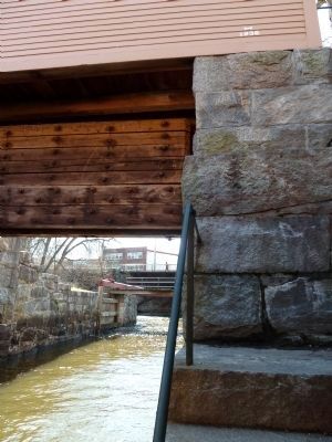
3. Looking Downstream Under the Gate
Water flowing freely under the raised gate. On the wall at right, note the marks recording the height reached by flood waters in 1852 (two-thirds of the way up) and 1936 (near the top). For legibility, click on the picture to enlarge it.
Credits. This page was last revised on October 8, 2020. It was originally submitted on April 28, 2011, by Roger W. Sinnott of Chelmsford, Massachusetts. This page has been viewed 1,087 times since then and 61 times this year. Last updated on October 17, 2011, by Michael Tiernan of Danvers, Massachusetts. Photos: 1, 2, 3. submitted on April 28, 2011, by Roger W. Sinnott of Chelmsford, Massachusetts. • Bill Pfingsten was the editor who published this page.

