Cheriton in Northampton County, Virginia — The American South (Mid-Atlantic)
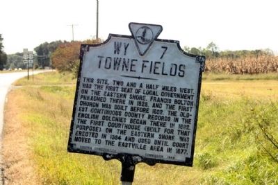
Towne Fields
Erected 1948 by Virginia Conservation Commission. (Marker Number WY-7.)
Topics and series. This historical marker is listed in these topic lists: Colonial Era • Settlements & Settlers. In addition, it is included in the Virginia Department of Historic Resources (DHR) series list. A significant historical year for this entry is 1623.
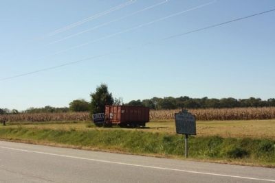
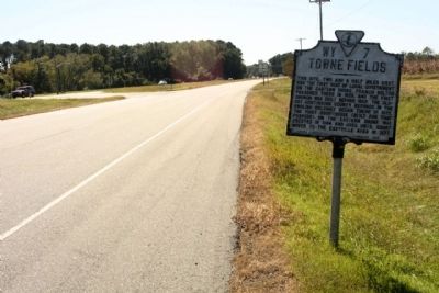
Location. This marker has been replaced by another marker nearby. It was located near 37° 17.688′ N, 75° 58.364′ W. Marker was in Cheriton, Virginia, in Northampton County. Marker was on Charles M Lankford Jr. Memorial Highway (U.S. 13), on the right when traveling south. Located north of Sams Road. Touch for map. Marker was in this post office area: Cheriton VA 23316, United States of America. Touch for directions.
Other nearby markers. At least 8 other markers are within 4 miles of this location, measured as the crow flies. Town Fields (a few steps from this marker); Stratton Manor (approx. 1.2 miles away); Salem Methodist Church (approx. 1.2 miles away); Eyre Hall (approx. 1.2 miles away); Site of Tidewater Institute (approx. 1.6 miles away); Cape Charles (approx. 2.7 miles away); Cape Charles Colored School (approx. 3 miles away); The Eastern Shore Railroad (approx. 3.1 miles away). Touch for a list and map of all markers in Cheriton.
Related marker. Click here for another marker that is related to this marker. New Marker At This Location titled "Town Fields"
Credits. This page was last revised on August 29, 2022. It was originally submitted on October 19, 2011, by Mike Stroud of Bluffton, South Carolina. This page has been viewed 870 times since then and 39 times this year. Photos: 1, 2, 3. submitted on October 29, 2011, by Mike Stroud of Bluffton, South Carolina.


