Oakland in Garrett County, Maryland — The American Northeast (Mid-Atlantic)
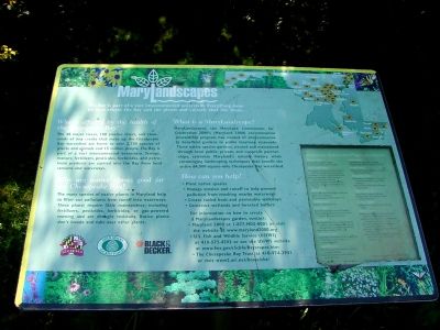
MaryLandscapes
Who is affected by the health of the Chesapeake Bay? The 48 major rivers, 100 smaller rivers, and thousands of tiny creeks that make up the Chesapeake Bay watershed are home to over 2,700 species of plants and animals and 15 million people. The Bay is part of a vast interconnected ecosystem. Sewage, manure, fertilizers, pesticides, herbicides, and petroleum products are carried into the Bay from local streams and waterways.
Why are native plants good for the Chesapeake Bay? The many species of native plants in Maryland help to filter out pollutants from runoff into waterways. These plants require little maintenance; including fertilizers, pesticides, herbicides, or gas-powered mowing and are drought resistant. Native plants don't invade and take over other plants.
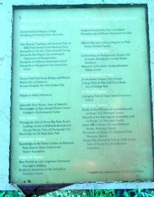
What is a MaryLandscape? MaryLandscapes, the Maryland Commission for Celebration 2000's (Maryland 2000) environmental stewardship program, has created 37 environmentally beneficial gardens in public locations statewide. These native species gardens, created and maintained through local public, private, and nonprofit partnerships, celebrate Maryland's natural history while encouraging landscaping techniques that benefit the entire 64,000-square-mile Chesapeake Bay watershed.
How can you help? Plant native species. Manage erosion and runoff to help prevent pollution from reaching nearby waterways. Create raised beds and permeable walkways. Construct wetlands and forested buffers. For more information on how to create a MaryLandscapes garden, contact: Maryland 2000 at 1-877-MD2-0001 or visit the website at www.maryland2000.org; U.S. Fish and Wildlife Service (USFWS) at 410-573-4593 or see the USFWS website at www.fws.gov/r5cbfo/Bayscapes.htm ; The Chesapeake Bay Trust at 410-974-2941 or visit www2.ari.net/home/cbt/
Erected by Maryland Commission for Celebration 2000's (Maryland 2000), Open Spaces Sacred Places, and Black & Decker.
Topics. This historical marker is listed in this topic list: Horticulture & Forestry. A significant historical year for this entry is 2000.
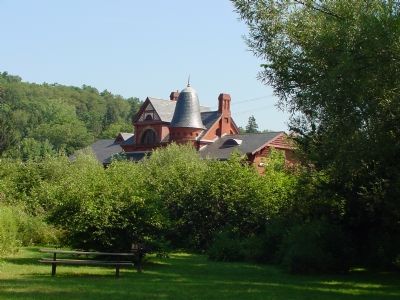
Location. 39° 24.54′ N, 79° 24.57′ W. Marker is in Oakland, Maryland, in Garrett County. Marker can be reached from the Town Parking Lot (Alley 3) near South 2nd Street and the RR Tracks. It is at Rotary Park, to the right of the Mountain Fresh Pavillion. Touch for map. Marker is in this post office area: Oakland MD 21550, United States of America. Touch for directions.
Other nearby markers. At least 5 other markers are within walking distance of this marker. Garrett County Courthouse (about 300 feet away, measured in a direct line); Gas House
(about 300 feet away); Railroad Street (about 300 feet away); The Oakland Hotel (about 300 feet away); B&O Mile Marker (about 300 feet away). Touch for a list and map of all markers in Oakland.
More about this marker. All three internet web references on the marker are no longer in service.
Regarding MaryLandscapes. The marker, in part, talks about the Chesapeake Bay watershed. But Oakland, where the marker has been placed, is not in the Chesapeake watershed. The eastern continental divide is east of here, in the next county. Oakland is in the Youghiogheny watershed, which drains into the Gulf of Mexico via the Monongahela, Ohio and Mississippi Rivers.
Credits. This page was last revised on July 14, 2019. It was originally submitted on August 17, 2006, by J. J. Prats of Powell, Ohio. This page has been viewed 1,893 times since then and 132 times this year. Photos: 1, 2. submitted on August 17, 2006, by J. J. Prats of Powell, Ohio. 3. submitted on August 11, 2006, by J. J. Prats of Powell, Ohio.
Editor’s want-list for this marker. Photo of Rotary Park entrance • Photos of Rotary Park plantings • Can you help?


