Paducah in McCracken County, Kentucky — The American South (East South Central)
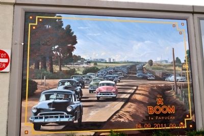
The "A" Boom in Paducah
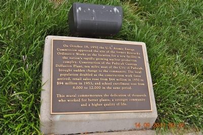
On October 18, 1950 the U.S. Atomic Energy commission approved the site of the former Kentucky Ordinance Works as the location for a new facility in the nation's rapidly growing nuclear production complex. Construction of the Paducah Gaseous Diffusion Plant, ten miles west of the City of Paducah, brought sudden change to the community. The local population doubled as the construction work force arrived, retail sales rose from $44 million in 1950 to $94 million in 1953, and school enrollment rose from 8,000 to 12,000 in the same period.
This mural commemorates the dedication of thousands who worked for better plants, a stronger community and a higher quality of life.
Topics. This historical marker is listed in this topic list: Industry & Commerce. A significant historical date for this entry is October 18, 1950.
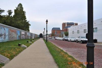
Location. 37° 5.232′ N, 88° 35.609′ W. Marker is in Paducah, Kentucky, in McCracken County. Marker is at the intersection of South Water Street and Kentucky Avenue, on the left when traveling south on South Water Street. Touch for map. Marker is in this post office area: Paducah KY 42003, United States of America. Touch for directions.
Other nearby markers. At least 8 other markers are within walking distance of this marker. Dawn of the Atomic Age (here, next to this marker); Welcome to the Atomic City (a few steps from this marker); Paducah's Railroad Heritage (a few steps from this marker); A Quick Stop (a few steps from this marker); Bicentennial of Paducah (a few steps from this marker); Iron Horse Memorial (a few steps from this marker); They Passed This Way (a few steps from this marker); The Pilothouse (within shouting distance of this marker). Touch for a list and map of all markers in Paducah.
Also see . . . The Paducah Wall to Wall Floodwall Mural Project. Renowned artist Robert Dafford and his team of muralists capture Paducah’s rich history in paintings on the city’s floodwall overlooking the confluence of the Ohio and Tennessee Rivers. (Submitted on October 25, 2011.)
Additional commentary.
1. Spelling on the marker
The spelling of Ordinance has been taken verbatim from the marker rather than the word Ordnance.
— Submitted March 10, 2021.
Credits. This page was last revised on March 10, 2021. It was originally submitted on October 24, 2011, by Sandra Hughes Tidwell of Killen, Alabama, USA. This page has been viewed 724 times since then and 32 times this year. Last updated on March 9, 2021, by Carl Gordon Moore Jr. of North East, Maryland. Photos: 1, 2, 3. submitted on October 24, 2011, by Sandra Hughes Tidwell of Killen, Alabama, USA. • Devry Becker Jones was the editor who published this page.


