Danvers in Essex County, Massachusetts — The American Northeast (New England)
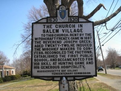
The Church in Salem Village
1630 – 1930
Erected 1930 by Massachusetts Bay Colony -Tercentenary Commission.
Topics and series. This historical marker is listed in these topic lists: Churches & Religion • Colonial Era. In addition, it is included in the Massachusetts Bay Colony—Tercentenary Commission Markers series list. A significant historical year for this entry is 1697.
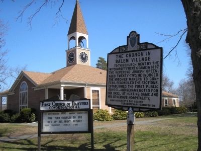
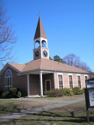
Location. 42° 33.884′ N, 70° 57.643′ W. Marker is in Danvers, Massachusetts, in Essex County. Marker is at the intersection of Hobart Street and Centre Street, on the left when traveling west on Hobart Street. Marker is located in front of the First Church of Danvers Congregational. Touch for map. Marker is in this post office area: Danvers MA 01923, United States of America. Touch for directions.
Other nearby markers. At least 8 other markers are within walking distance of this marker. Samuel Parris Archaeological Site (about 600 feet away, measured in a direct line); Salem Village Parsonage (about 700 feet away); The 1681 Salem Village Parsonage (about 700 feet away); The 1734 Addition (about 700 feet away); Salem Village Meeting House (approx. 0.2 miles away); Salem Village Witchcraft Victims’ Memorial (approx. 0.2 miles away); Deacon Nathaniel Ingersoll (approx. ¼ mile away); Village Training Field (approx. ¼ mile away). Touch for a list and map of all markers in Danvers.
Related markers. Click here for a list of markers that are related to this marker. To better understand the relationship, study each marker in the order shown.
Also see . . . Historical markers erected by Massachusetts Bay Colony. Original 1930 publication by the Commonwealth of Massachusetts of Tercentenary Commission Markers, commemorating the three hundredth anniversary of the Massachusetts Bay Colony. (Submitted on November 17, 2009, by Russell Chaffee Bixby of Bernardston, Massachusetts.)
Credits. This page was last revised on November 4, 2018. It was originally submitted on April 16, 2009, by Bill Coughlin of Woodland Park, New Jersey. This page has been viewed 5,258 times since then and 318 times this year. Last updated on October 25, 2011, by Michael Tiernan of Danvers, Massachusetts. Photos: 1, 2, 3. submitted on April 16, 2009, by Bill Coughlin of Woodland Park, New Jersey. • Bill Pfingsten was the editor who published this page.


