Deerfield in Franklin County, Massachusetts — The American Northeast (New England)
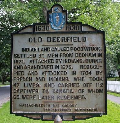
Old Deerfield
1630 - 1930
Erected 1930 by Massachusetts Bay Colony-Tercentenary Commission.
Topics and series. This historical marker is listed in these topic lists: Colonial Era • Native Americans • Settlements & Settlers. In addition, it is included in the Massachusetts Bay Colony—Tercentenary Commission Markers series list. A significant historical year for this entry is 1671.
Location. 42° 32.51′ N, 72° 36.326′ W. Marker is in Deerfield, Massachusetts, in Franklin County. Marker is on Old Main Street near Wells Street, on the left when traveling north. Touch for map. Marker is in this post office area: Deerfield MA 01342, United States of America. Touch for directions.
Other nearby markers. At least 8 other markers are within walking distance of this marker. Wells-Thorn House (about 600 feet away, measured in a direct line); Lucy Terry Prince / Caesar (about 600 feet away); Benjamin Barrett (approx. 0.2 miles away); Godfrey Nims (approx. 0.2 miles away); Memorial Hall (approx. 0.2 miles away); Godfrey Nims Home Lot (approx. 0.2 miles away); Barnard Tavern (approx. 0.2 miles away); Frary House (approx. 0.2 miles away). Touch for a list and map of all markers in Deerfield.
Also see . . .
1. Historic Deerfield. A museum of New England history and art, provides information on collections, area descendants, and tours. (Submitted on November 17, 2009, by Russell Chaffee Bixby of Bernardston, Massachusetts.)
2. Historical markers erected by Massachusetts Bay Colony. Original 1930 publication by the Commonwealth of Massachusetts of Tercentenary Commission Markers, commemorating the three hundredth anniversary of the Massachusetts Bay Colony. (Submitted on November 17, 2009, by Russell Chaffee Bixby of Bernardston, Massachusetts.)
Additional commentary.
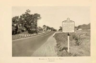
1. Second Old Deerfield Marker
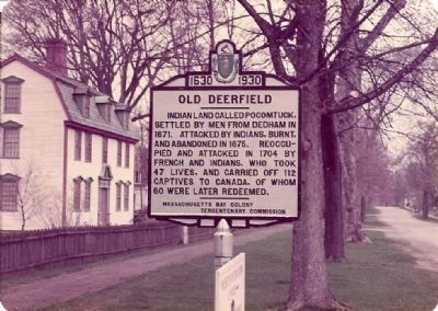
The above reference source (Historical markers erected by Massachusetts Bay Colony (1930)) indicates that marker is located on "Route 5 near southern entrance to 0ld Deerfield," but actually it can be found on Main Street of Old Deerfield Village in front of the Dwight House, just off Route 5.
A second marker is located at the north entrance of Old Deerfield on Route 5, as indicated in Historical markers erected by Massachusetts Bay Colony. Either the original second marker was not made of cast iron, or a reproduction done on laminated wood replaced the original. It is barely legible in 2009, having suffered from vandalism and weathering.
A complete 1930 catalog of Historical Markers Erected by Massachusetts Bay Colony Tercentenary Commission is available from the link above. Note To Editor only visible by Contributor and editor
— Submitted November 16, 2009, by Russell Chaffee Bixby of Bernardston, Massachusetts.

circa 1930
3. Old Deerfield Marker
A second marker is located at the north entrance of Old Deerfield on Route 5. Either the original second marker was not made of cast iron, or a reproduction done on laminated wood replaced the original. It is barely legible in 2009, having suffered from vandalism and weathering. This photo is from a 1930 publication, a facsimile of the original sign placed on a photo taken at the location.
Credits. This page was last revised on September 29, 2020. It was originally submitted on September 30, 2009, by Ronald G. Heroux of White River Junction, Vermont. This page has been viewed 2,423 times since then and 66 times this year. Last updated on October 26, 2011, by Russell Chaffee Bixby of Bernardston, Massachusetts. Photos: 1. submitted on November 16, 2009, by Russell Chaffee Bixby of Bernardston, Massachusetts. 2. submitted on September 30, 2009, by Ronald G. Heroux of White River Junction, Vermont. 3. submitted on November 17, 2009, by Russell Chaffee Bixby of Bernardston, Massachusetts. • Bill Pfingsten was the editor who published this page.

