Spata in Hancock County, Georgia — The American South (South Atlantic)
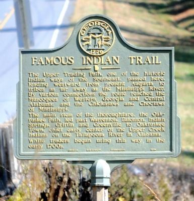
Famous Indian Trail
The main stem of the thoroughfare, the Oakfuskee Path, led past Warrenton, Eatonton, Indian Springs, Griffin and Greenville to Oakfuskee Town, chief early center of the Upper Creek Indians on the Tallapoosa River in Alabama.
White traders began using this way in the early 1700s.
Erected 1954 by Georgia Historical Commission. (Marker Number 070-1.)
Topics and series. This historical marker is listed in these topic lists: Native Americans • Roads & Vehicles. In addition, it is included in the Georgia Historical Society series list.
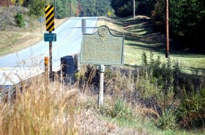
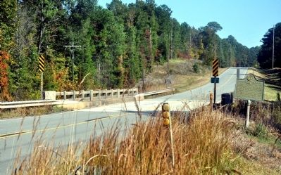
Location. 33° 20.733′ N, 83° 5.977′ W. Marker is in Spata, Georgia, in Hancock County. Marker is on Georgia Route 16, 0.3 miles east of Green Springs Road, on the right when traveling east. The marker stands at the bridge over Little Shoulderbone Creek. Touch for map. Marker is in this post office area: Sparta GA 31087, United States of America. Touch for directions.
Other nearby markers. At least 8 other markers are within 9 miles of this marker, measured as the crow flies. Shoulder-bone Creek Treaty (approx. 1.2 miles away); “July” 1858 (approx. 2 miles away); Gov. William Jonathan Northen (approx. 5.4 miles away); Mt. Zion Church (approx. 5.6 miles away); Nathan S.S. Beman at Mt. Zion (approx. 5.7 miles away); Liberty Chapel (approx. 6.7 miles away); Rockville School (approx. 7 miles away); "Old Dominion" (approx. 8.4 miles away).
Credits. This page was last revised on June 16, 2016. It was originally submitted on October 28, 2011, by David Seibert of Sandy Springs, Georgia. This page has been viewed 1,249 times since then and 81 times this year. Photos: 1, 2, 3. submitted on October 28, 2011, by David Seibert of Sandy Springs, Georgia. • Craig Swain was the editor who published this page.


