Mount Washington in Pittsburgh in Allegheny County, Pennsylvania — The American Northeast (Mid-Atlantic)
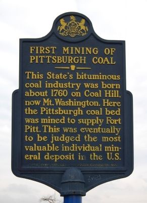
First Mining of Pittsburgh Coal
Erected 1985 by Pennsylvania Historical and Museum Commission.
Topics and series. This historical marker is listed in this topic list: Industry & Commerce. In addition, it is included in the Pennsylvania Historical and Museum Commission series list. A significant historical year for this entry is 1760.
Location. 40° 26.065′ N, 80° 0.678′ W. Marker is in Pittsburgh, Pennsylvania, in Allegheny County. It is in Mount Washington. Marker is on Grandview Avenue, 0 miles west of Bertha Street, on the right when traveling west. Located across Grandview Avenue from St. Mary of the Mount Church, near the overlook. Touch for map. Marker is in this post office area: Pittsburgh PA 15211, United States of America. Touch for directions.
Other nearby markers. At least 8 other markers are within walking distance of this marker. Commerce Court (approx. 0.3 miles away); Bessemer Converter (approx. 0.4 miles away); Clinton Furnace (approx. 0.4 miles away); Railings from the Brady Street Bridge (approx. 0.4 miles away); Rev. John McMillan (approx. 0.4 miles away); P & LE Terminal (approx. 0.4 miles away); Chuck Muer (approx. 0.4 miles away); Flag Bastion (approx. 0.4 miles away). Touch for a list and map of all markers in Pittsburgh.
Also see . . . Pittsburgh Coal Seam. Wikipedia article about Pittsburgh Coal. (Submitted on October 31, 2011, by Mike Wintermantel of Pittsburgh, Pennsylvania.)

Photographed By Wilbur G. Burroughs, March 14, 1914
3. Pittsburgh Coal Seam
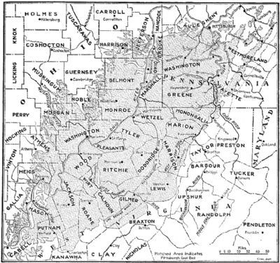
"Map of the Horizon of the Pittsburgh Coal Bed in Pennsylvania, West Virginia and Ohio -- The Maryland deposit is excluded. It will be noted in the illustration that in West Virginia there is a line which shows where the Pittsburgh bed becomes thin and of little commercial value. While some of the deposits west of that line in Ohio are of considerable value, many are utterly valueless, and some are mere traces. In other places, the bed is missing and its horizon alone can be determined. As this is a map covering the horizon of the coal bed and not its actual presence, the profitable coal area, especially in Ohio and West Virginia, will be considerably smaller than that shown."
Date 14 March 1914(1914-03-14)
Source The Pittsburgh Coal Bed, Coal Age, Vol. 5, No. 11 (March 14, 1914); page 441.
Credits. This page was last revised on February 2, 2023. It was originally submitted on October 28, 2011, by Mike Wintermantel of Pittsburgh, Pennsylvania. This page has been viewed 822 times since then and 35 times this year. Photos: 1, 2. submitted on October 28, 2011, by Mike Wintermantel of Pittsburgh, Pennsylvania. 3. submitted on October 31, 2011, by Mike Wintermantel of Pittsburgh, Pennsylvania.

