Thorold in Niagara Region, Ontario — Central Canada (North America)
Beaver Dams
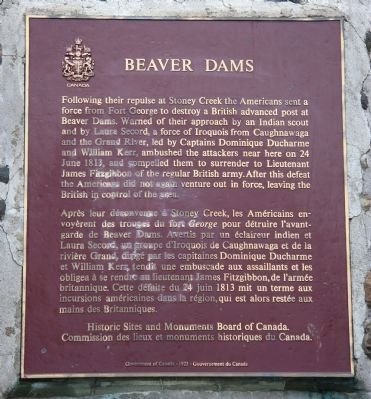
Après leur déconvenue à Stoney Creek, les Américains envoyèrent des troupes du fort George pour détruire l'avant-garde de Beaver Dams. Avertis par un éclaireur indien et Laura Secord, un groupe d'Indiens de Caughnawaga et de la rivière Grand, dirigé par les capitaines Dominique Ducharme et William Kerr, tandit une embuscade aux assaillants et les obligea à se rendre au lieutenant James Fitzgibbon, de l'armée britannique. Cette défaite du 24 juin 1813 mit un terme aux incursions américaines dans la région, qui est alors, restée aux mains des Britanniques.
Erected by Historic Sites and Monuments Board of Canada.
Topics. This historical marker is listed in these topic lists: Colonial Era • War of 1812. A significant historical date for this entry is June 24, 1813.
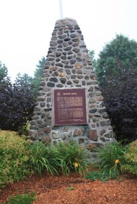
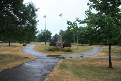
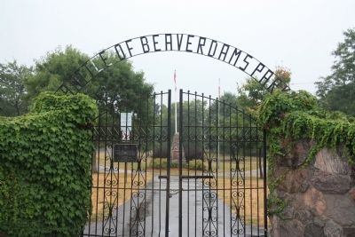
Location. 43° 7.367′ N, 79° 12.091′ W. Marker is in Thorold, Ontario, in Niagara Region. Marker can be reached from Sullivan Avenue south of Towpath Road, on the right when traveling east. This historic marker is located in Beaversdam Battlefield Park, near the north entrance to the park, along a walking trail that runs north to south through the park, just southwest of the downtown business district. Touch for map. Marker is in this post office area: Thorold ON L2V 0A7, Canada. Touch for directions.
Other nearby markers. At least 8 other markers are within 5 kilometers of this marker, measured as the crow flies. Laura Ingersoll Secord (a few steps from this marker); Arthur S. Whelan (within shouting distance of this marker); In Memory of John Bean, Ph.D., M.D. (within shouting distance of this marker); In Memory of Unknown American Soldiers (within shouting distance of this marker); The Founding of Thorold (about 120 meters away, measured in a direct line); Old Thorold Firehall (approx. 0.2 kilometers away); Lock 24 - First Welland Canal (approx. 1.5 kilometers away); Vertical Lift Bridges (approx. 3.6 kilometers away). Touch for a list and map of all markers in Thorold.
More about this marker. According to the "Guidebook to the Historic Sites of the War of 1812," written by Gilbert Collins, the historic marker for the Battle of Beavers Dam is no longer situated at the site of the actual battlefield. The guidebook notes, "A monument to the victory of Beaver Dams was erected by the Historic Sites and Monuments Board of Canada in 1923. For decades it stood near the spot where Boerstler's troops surrendered, but in a move of questionable intelligence the monument was moved from its original site to 'Battle of Beaver Dams Park' in the city of Thorold."
The guidebook goes on to state, "The Battle of Beavers Dam, which had been a 'marked' site for over fifty years, now has the embarrassing distinction of being an 'unmarked' site. The actual battlefield is at the intersection of Thorold Stone Road and Davis Road, in the Regional Municipality of Niagara. The old monument, which was dedicated in 1923, was placed at the approximate centre of the battlefield ... Unfortunately, the old monument of 1823 is no longer on the battlefield, and was moved into 'Battle of Beaver Dams Park' in the city of Thorold."
Related markers. Click here for a list of markers that are related to this marker. To better understand the relationship, study each marker in the order shown.
Also see . . .
1. Battle of Beaver Dams. This is a link to information provided by Wikipedia, the free encyclopedia. (Submitted on November 5, 2011, by Dale K. Benington of Toledo, Ohio.)
2. Battle of Beaver Dams, 24 June 1813. This is a link to information
provided by the Military History Encyclopedia on the Web. (Submitted on November 5, 2011, by Dale K. Benington of Toledo, Ohio.)
3. Battle of Beaver Dams National Historic Site of Canada. This is a link to information from a website administered by Parks Canada. (Submitted on November 5, 2011, by Dale K. Benington of Toledo, Ohio.)
Additional commentary.
1. Battle at Bever Dams
My -g-grandfather NATHANIEL WHEELER NILES, was captured at this battlefield, on 24 June 1813. He was imprisoned in Toronto, Kingston, Montreal and on Mellville Island in Halifax (for 2 months). He and others, were then put on the frigate Nemesis and sent to England. There he was at Portsmouth Spithead from 25 Dec 1813 until 15 Jan 1814. Then they were sent to Chatham, 30 miles from London. They were confined on the prison ship Crown Prince Frederick. On 08 Jan 1815, they set sail for home. Note To Editor only visible by Contributor and editor
— Submitted April 16, 2012, by Joan Watson Frederich of Lakeland, Florida.
Credits. This page was last revised on August 6, 2020. It was originally submitted on October 28, 2011, by Dale K. Benington of Toledo, Ohio. This page has been viewed 876 times since then and 22 times this year. Photos: 1, 2, 3, 4. submitted on November 1, 2011, by Dale K. Benington of Toledo, Ohio.


