Cumberland in Allegany County, Maryland — The American Northeast (Mid-Atlantic)
Capture of Generals
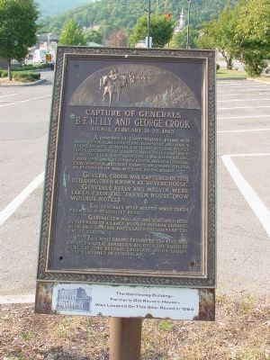
Capture of Generals B.F. Kelly and George Crook
— Nights, February 21–22, 1865 —
A company of Confederates, young men from Cumberland, Maryland, Hampshire and Hardy Counties, West Virginia, captured several picket posts, obtained the countersign “Bulls Gap,” rode into the city, captured two commanding Union Generals, Kelly and Crook, and Adj. General Thayer Melvin, and sent them to Richmond, Virginia, as prisoners of war, without firing a shot.
General Crook was captured in this building, then known as “Revere House.” Generals Kelly and Melvin were taken from the “Barnum House,” (now Windsor Hotel).
The generals were asleep when taken from their respective beds.
General Lew Wallace was stationed here, in command of a large body of Indiana Zouaves; also Brig. General Hayes, later President of the United States.
This most daring episode of the Civil War created a great sensation all over the country, as at the time several thousand Union troops were stationed in Cumberland.
(The Kenneweg Building—formerly old Revere House—was located on this site. Razed in 1964.)
Topics and series. This historical marker is listed in this topic list: War, US Civil. In addition, it is included in the Believe It or Not series list. A significant historical year for this entry is 1964.
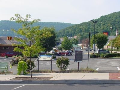
Location. 39° 39.133′ N, 78° 45.547′ W. Marker is in Cumberland, Maryland, in Allegany County. Marker is at the intersection of Baltimore Street and Queen City Drive, on the left when traveling east on Baltimore Street. Touch for map. Marker is in this post office area: Cumberland MD 21502, United States of America. Touch for directions.
Other nearby markers. At least 5 other markers are within walking distance of this marker. McNeill’s Raid (here, next to this marker); A Boom for Cumberland (within shouting distance of this marker); Capture of Generals B.F. Kelly and George Crook (within shouting distance of this marker); Christ's (St. Paul's) Lutheran Church (about 600 feet away, measured in a direct line); B’er Chayim (Well of Life) Congregation (about 700 feet away). Touch for a list and map of all markers in Cumberland.
More about this marker. This marker was originally mounted on the Kenneweg Building at this site. After the building was razed, it was staked next to the sidewalk.
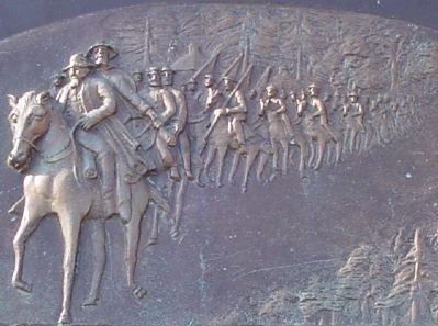
Regarding Capture of Generals. The Confederates, led by Lt. Jesse McNeill, went to the two hotels where the Generals were sleeping, entered their rooms, woke them up, announced they were prisoners, and waited for them to dress. They then walked the prisoners out to the street where they were “mounted upon horses, the owners of which courteously gave the prisoners the saddle, and rode behind. In this manner they were taken out of Cumberland ...” Others sleeping
in adjacent rooms were not disturbed. (Quote from the 1923 book History of Allegany County Maryland, by James W Thomas and Judge T J C Williams.)
Related marker. Click here for another marker that is related to this marker.
Additional keywords. Lt. Jesse McNeill
Credits. This page was last revised on June 14, 2022. It was originally submitted on August 18, 2006, by J. J. Prats of Powell, Ohio. This page has been viewed 20,717 times since then and 644 times this year. Photos: 1, 2, 3. submitted on August 18, 2006, by J. J. Prats of Powell, Ohio.


