Near St. Francis in Clay County, Arkansas — The American South (West South Central)
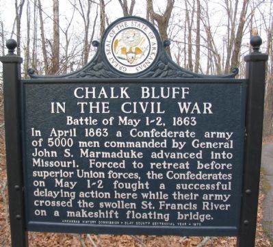
Chalk Bluff in the Civil War
Battle of May 1-2, 1863
Inscription.
In April 1863 a Confederate army of 5000 men commanded by General John S. Marmaduke advanced into Missouri. Forced to retreat before superior Union forces, the Confederates on May 1-2 fought a successful delaying action here while their army crossed the swollen St. Francis River on a makeshift floating bridge.
Erected 1973 by Arkansas History Commission - Clay County Centennial Year.
Topics. This historical marker is listed in this topic list: War, US Civil. A significant historical month for this entry is April 1863.
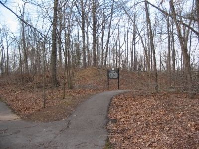
Location. 36° 28.813′ N, 90° 9.733′ W. Marker is near St. Francis, Arkansas, in Clay County. Marker is on County Route 347. Located at the start of a walking trail in Chalk Bluff Battlefield Park. Touch for map. Marker is in this post office area: Piggott AR 72454, United States of America. Touch for directions.
Other nearby markers. At least 5 other markers are within walking distance of this marker. Chalk Bluff Crossing and Town (about 400 feet away, measured in a direct line); a different marker also named Chalk Bluff in the Civil War (about 700 feet away); a different marker also named Chalk Bluff in the Civil War (about 700 feet away); Chalk Bluff (about 800 feet away); The Battle at Chalk Bluff (approx. 0.6 miles away in Missouri).
Additional commentary.
1. Local Legends
Local legend holds that the Confederates had captured either a Federal payroll or some other treasure during Marmaduke's raid. The captured loot, according to legend, was dumped into the river as the Federals closed in on the river crossing site. While rather romantic, this writer discounts the story. After all, most soldiers were paid in paper script, which would leave nothing for the 21st century visitor.
— Submitted January 23, 2008, by Craig Swain of Leesburg, Virginia.
Photographed By Craig Swain, circa 1998
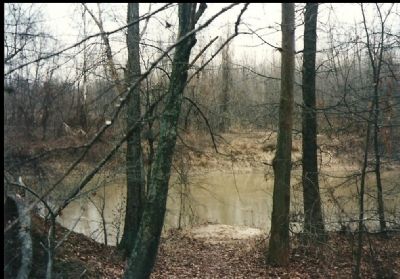
4. Ferry Crossing Site
The town of Chalk Bluff is nothing more than a place name today, but during the 19th century it was an important local crossing point over the St. Francis River. The far side of the river here is Dunklin County, Missouri. Later in May 1863, Confederates were forced to cross the river by way of a rudimentary floating bridge.
Photographed By Craig Swain, circa 1998
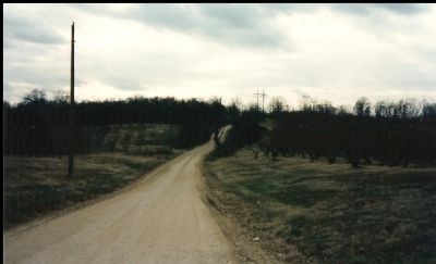
6. Military Road on the Missiouri Side
This section of road in Dunklin County traces the route of the old Military Road running across Crowley's Ridge. The rise in the distance is locally known as Gravel Hill and was used by the Confederates to delay the Federals approaching the ferry (or more accurately the fabricated bridge) site.
Credits. This page was last revised on July 26, 2018. It was originally submitted on January 23, 2008, by Craig Swain of Leesburg, Virginia. This page has been viewed 2,918 times since then and 50 times this year. Photos: 1. submitted on April 22, 2009, by Craig Swain of Leesburg, Virginia. 2. submitted on January 23, 2008, by Craig Swain of Leesburg, Virginia. 3. submitted on April 22, 2009, by Craig Swain of Leesburg, Virginia. 4. submitted on January 22, 2008, by Craig Swain of Leesburg, Virginia. 5, 6. submitted on January 23, 2008, by Craig Swain of Leesburg, Virginia.
