Mentor in Lake County, Ohio — The American Midwest (Great Lakes)
Gasholder Building
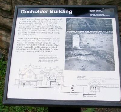
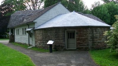
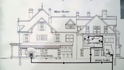
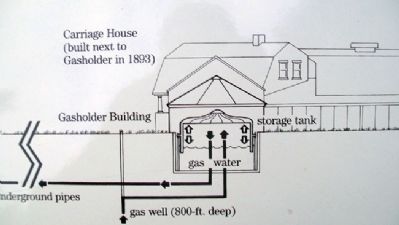
In 1885, workers discovered an abundant supply of natural gas at Lawnfield and built a stone-and-brick gasholder building. A few years later, workers drilled a new 800-foot-deep gas well and, in 1893, reduced the gasholder building by one-half when building the Carriage House. With this system, Lucretia Garfield owned her own gas works for her household lighting, heating, and cooking fixtures.
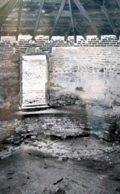
Inside, a five-foot-deep metal storage tank held the natural gas until it was piped into the main house. The circular tank, about 20 feet in diameter, rose and fell with the amount of gas it held. Eventually, public utilities supplied natural gas and, by 1944, the gaslight fixtures had been converted to electric lighting.
[Inset caption reads] Inside this building are the remnants of the natural gas storage and distribution system that Lucretia Garfield used to light and heat Lawnfield.
Erected by National Park Service.
Topics. This historical marker is listed in this topic list: Man-Made Features. A significant historical year for this entry is 1885.
Location. 41° 39.894′ N, 81° 21.045′ W. Marker is in Mentor, Ohio, in Lake County. Marker is on the grounds of James A. Garfield National Historic Site. Touch for map. Marker is at or near this postal address: 8095 Mentor Avenue, Mentor OH 44060, United States of America. Touch for directions.
Other nearby markers. At least 8 other markers are within walking distance of this marker. James A. Garfield's "Lawnfield" (within shouting distance of this marker); Carriage House (within shouting distance of this marker); Lawnfield (within shouting distance of this marker); James A. Garfield and the Civil War (within shouting distance of this marker); Windmill (within shouting distance of this marker); Campaign Office (about 300 feet away, measured in a direct line); Garfield's Farm (about 300 feet away); Expanding the House (about 300 feet away). Touch for a list and map of all markers in Mentor.
Also see . . . James A. Garfield National Historic Site. (Submitted on November 4, 2011, by William Fischer, Jr. of Scranton, Pennsylvania.)
Credits. This page was last revised on December 27, 2018. It was originally submitted on November 4, 2011, by William Fischer, Jr. of Scranton, Pennsylvania. This page has been viewed 437 times since then and 14 times this year. Photos: 1, 2, 3, 4, 5. submitted on November 4, 2011, by William Fischer, Jr. of Scranton, Pennsylvania. 6. submitted on December 13, 2018, by Allen C. Browne of Silver Spring, Maryland.
