Mentor in Lake County, Ohio — The American Midwest (Great Lakes)
Windmill
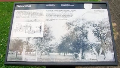
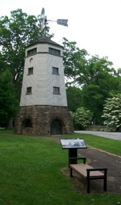
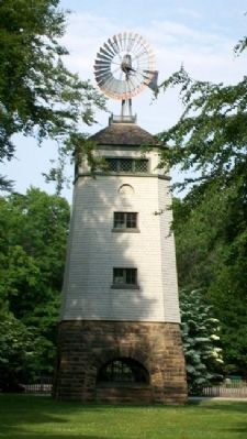
The Garfield family' windmill towered 60 feet above its stone base. Lucretia had the original tower built in 1894 to overcome problems with an old polluted well and a gas engine water pump she had installed in 1885. The new tower provided the property with a "feature," a common trait of Cleveland area estates.
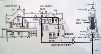
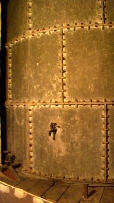
The Garfields' windmill pumped water into a 500-barrel holding tank in the windmill tower. From there, the water was gravity-fed into a 300-gallon, galvanized holding tank on the third floor of the house. Water then flowed to faucets in the kitchen, bathrooms, and laundry rooms. The windmill also pumped water to other farm locations. By 1939, this system was replaced by Mentor's village water supply.
[Background photo caption reads] The windmill and a portion of the orchard that surrounded it in the early 1900s.
Erected by National Park Service.
Topics. This historical marker is listed in this topic list: Man-Made Features. A significant historical year for this entry is 1894.
Location. 41° 39.87′ N, 81° 21.025′ W. Marker is in Mentor, Ohio, in Lake County. Marker is on the grounds of James A. Garfield National Historic Site. Touch for map. Marker is at or near this postal address: 8095 Mentor Avenue, Mentor OH 44060, United States of America. Touch for directions.
Other nearby markers. At least 8 other markers are within walking distance of this marker. Gasholder Building (within shouting distance of this marker); Campaign Office (within shouting distance of this marker); Expanding the House (within shouting distance of this marker); Carriage House (within shouting distance of this marker); James A. Garfield's "Lawnfield" (about 300 feet away, measured in a direct line); Lawnfield (about 300 feet away); James A. Garfield and the Civil War (about 300 feet away); Front Porch Campaign (about 300 feet away). Touch for a list and map of all markers in Mentor.
Also see . . . James A. Garfield National Historic Site. (Submitted on November 4, 2011, by William Fischer, Jr. of Scranton, Pennsylvania.)
Credits. This page was last revised on June 16, 2016. It was originally submitted on November 4, 2011, by William Fischer, Jr. of Scranton, Pennsylvania. This page has been viewed 519 times since then and 12 times this year. Photos: 1, 2, 3, 4, 5. submitted on November 4, 2011, by William Fischer, Jr. of Scranton, Pennsylvania.
