Cumberland in Allegany County, Maryland — The American Northeast (Mid-Atlantic)
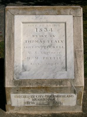
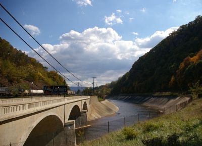
Site of Bridge 1834
Thomas Fealy
Lieut. Jno. Pickell
U.S. Engineer
H. M. Pettit
Ass’t Supd’t.
Erected 1955 by City of Cumberland Bicentennial.
Topics. This historical marker is listed in these topic lists: Bridges & Viaducts • Roads & Vehicles.
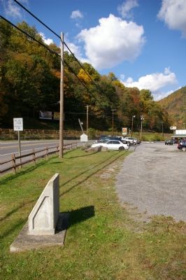
Location. 39° 39.769′ N, 78° 46.856′ W. Marker is in Cumberland, Maryland, in Allegany County. Marker is on National Highway (U.S. 40), on the right when traveling north. Touch for map. Marker is at or near this postal address: 10307 National Highway, Cumberland MD 21502, United States of America. Touch for directions.
Other nearby markers. At least 8 other markers are within walking distance of this marker. “The Narrows” (a few steps from this marker); The Narrows (a few steps from this marker); a different marker also named The Narrows (about 300 feet away, measured in a direct line); To The Unknown Confederate Dead (approx. 0.6 miles away); Civil War Soldiers Monument (approx. 0.6 miles away); 617 Washington Street (approx. ¾ mile away); 632 Washington Street (approx. ¾ mile away); 615 Washington Street (approx. ¾ mile away). Touch for a list and map of all markers in Cumberland.
Credits. This page was last revised on June 16, 2016. It was originally submitted on January 23, 2008, by Christopher Busta-Peck of Shaker Heights, Ohio. This page has been viewed 1,647 times since then and 20 times this year. Photos: 1, 2, 3. submitted on January 23, 2008, by Christopher Busta-Peck of Shaker Heights, Ohio. • Craig Swain was the editor who published this page.


