Jersey City in Hudson County, New Jersey — The American Northeast (Mid-Atlantic)
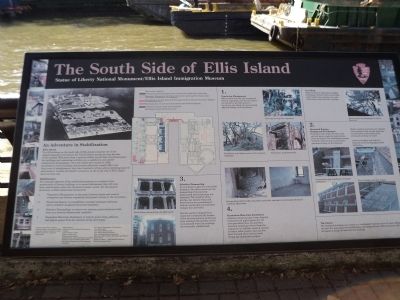
The South Side of Ellis Island
— Statue of Liberty Natl Mon/Ellis Island Immigration Museum —
An Adventure in Stabilization
Ellis Island
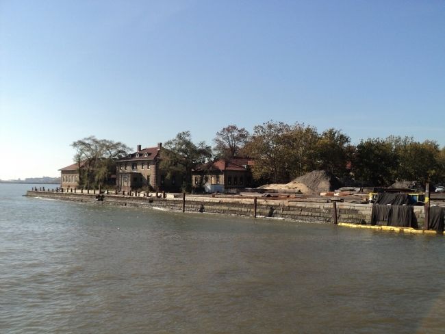
The 29 buildings on the south side of Ellis Island comprise one of the largest hospitals to be built in the United States during the first decades of this [20th] century. With more than a quarter million square feet of enclosed space, the buildings and connecting corridors are a significant and unified architectural development. Once the island was vacated in 1954, maintenance of the buildings and grounds effectively ceased. After over forty years of abandonment, they have reached a critical and accelerating state of deterioration. Luckily, the historic structures on the south side of Ellis Island have not been lost.
Stabilization
The principle objective of the stabilization process as it relates to the preservation of historic buildings is to correct deficiencies that will slow down deterioration while the structures remain vacant. For the historic structures on Ellis Island this consisted of:
1. Vegetation Management: to document historic plants and remove overgrown non-historic vegetation that posed a threat to the structures.
2. Structural Repairs: to reestablish a weather resistant enclosure and to reinforce weakened structural members.
3. Selective Dismantling: to remove two exterior porch structures that were in a severely deteriorated condition.
4. Hazardous Materials Abatement: to remove paint chips, asbestos and pigeon guano from the interiors of the structures.
[ Sidebar : ]
1.
Vegetation Management
After careful analysis and mapping of historic vegetation, non-historic plants are cleared to provide access to structures and eliminate trees causing physical damage to the structures.
Tree Work
Skilled arborists using special rigging techniques carefully remove tree limbs and/or entire trees leaning over roofs where they caused extensive damage.
2.
Structural Repairs:
Keeping out the Elements
Numerous entry points for rain, wind and salt spray accelerate deterioration of the structures. The stabilization process therefore, seeks to seal up all these openings to keep out the elements.
Broken windows and doors are replaced with enclosures that provide necessary air circulation to the inside of the structures yet keep out water.
Likewise skylights and roofs are repaired to prevent damaging water infiltration.
3.
Selective Dismantling
In an attempt to prevent irreversible damage to two of the structures the dismantling of two severely deteriorated exterior porches was necessary. The condition of the porches was beyond repair and deterioration was proceeding at such an accelerated rate that their collapse was inevitable.
Had the porches collapsed they would have destroyed the facades of the two structures to which they were attached. The porches will be reconstructed when the buildings are eventually rehabilitated.
4.
Hazardous Materials Abatement
Asbestos containing pipe wrap, chipping lead paint and pigeon guano are the most prevalent forms of hazardous materials requiring removal from the structures. In addition, removal of years of debris, fallen plaster, dust and dirt form the bulk of the interior work during the stabilization project.
The Future
The stabilized buildings can remain in a “mothballed” state for up to 15 years. Within the next few years plans for rehabilitation and adapted reuse of the structures will be developed to bring life back into the buildings.
Erected by National Park Service.
Topics. This historical marker is listed in this topic list: Notable Buildings. A significant historical year for this entry is 1954.
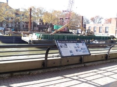
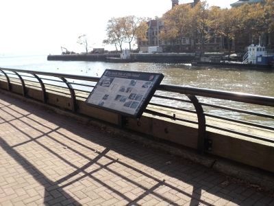
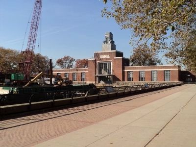
Location. 40° 41.959′ N, 74° 2.465′ W. Marker is in Jersey City, New Jersey, in Hudson County. Marker can be reached from Liberty Island - Ellis Island. Marker is located near the end of the ferry slip on Ellis Island. Touch for map. Marker is at or near this postal address: 1 Liberty Island - Ellis Island, Jersey City NJ 07305, United States of America. Touch for directions.
Other nearby markers. At least 8 other markers are within walking distance of this marker. The New Ferry Building – Ellis Island (here, next to this marker); The American Immigrant Wall of Honor ® (about 500 feet away, measured in a direct line in New York); Fort Gibson: The Other Ellis Island Story (about 600 feet away in New York); Fort Gibson: Uncovering the Past (about 600 feet away in New York); a different marker also named The American Immigrant Wall of Honor ® (about 700 feet away in New York); Delaware Indian Burials (about 700 feet away in New York); Fort Gibson: Defending the Approaches (about 700 feet away in New York); Fort Gibson: The New York Harbor System (about 700 feet away in New York).
More about this marker. An aerial view of Ellis Island appears at the upper left of the marker. Next to this is a layout of the Island detailing the progress of the restoration on the buildings on the south side of the Island.
Several photos accompany each item of the sidebar. The Vegetation Management section includes a photo of a worker clearing overgrown vegetation, the Psychiatric ward before the removal of overgrown vegetation, and the Psychiatric ward afterwards. The Tree Work section contains a photo of an Arborist removing damaging tree limbs from a roof. The Structural Repairs section includes photos of
construction and installation of window enclosures, and of a flat roof before and after repairs. Photos in the Selective Dismantling section depict a porch on one of the structures before dismantling and after its removal. The Hazardous Materials Abatement section contains photos of accumulated debris before hazardous materials abatement and an example of typical condition afterwards.
Credits. This page was last revised on October 10, 2022. It was originally submitted on November 8, 2011, by Bill Coughlin of Woodland Park, New Jersey. This page has been viewed 546 times since then and 10 times this year. Photos: 1, 2, 3, 4, 5. submitted on November 8, 2011, by Bill Coughlin of Woodland Park, New Jersey.
