Yountville in Napa County, California — The American West (Pacific Coastal)
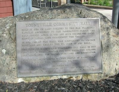
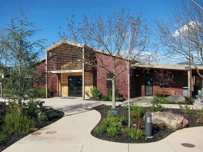
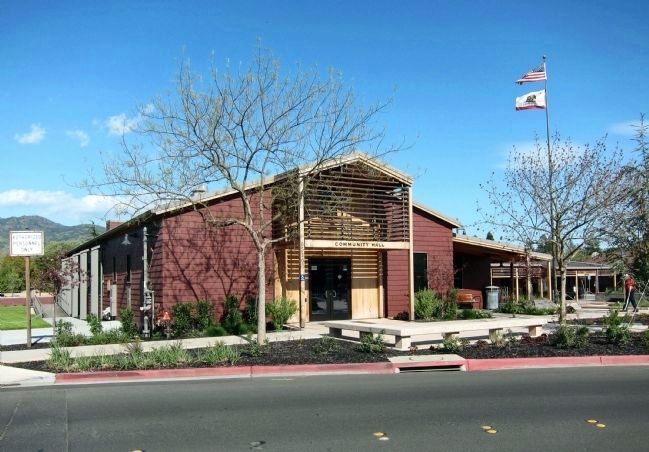
Yountville Community Hall
In 1956 use of the hall was restricted to church functions and called the St. Joan of Arc Hall.
The City of Yountville purchased the hall in 1965 and used a small portion for city hall. The building was again used for social functions and recreation.
Remodeled and dedicated to "The People of Yountville" by the Town Council September 24, 1988.
Colonel Nelson M. Holderman No. 316 Parlor N.S.G.W.
Geo. C. Yount No. 322 Parlor N.D.G.W.
Erected by Native Sons of the Golden West, Parlor No. 316 and Native Daughters of the Golden West Parlor No. 322.
Topics and series. This historical marker is listed in these topic lists: Churches & Religion • Entertainment. In addition, it is included in the Native Sons/Daughters of the Golden West series list. A significant historical date for this entry is April 17, 1890.
Location. 38° 24.114′ N, 122° 21.637′ W. Marker is in Yountville, California, in Napa County. Marker is at the intersection of Washington Street and Yount Street, on the left when traveling south on Washington Street. Touch for map. Marker is at or near this postal address: 6516 Washington Street, Yountville CA 94599, United States of America. Touch for directions.
Other nearby markers. At least 8 other markers are within walking distance of this marker. George Yount's Millstones (a few steps from this marker); Map of Groezinger's Addition (a few steps from this marker); Groezinger Winery (about 400 feet away, measured in a direct line); Flags over California in 1870 (about 400 feet away); Yountville (about 700 feet away); Yountville's First Fire House (approx. ¼ mile away); Veterans Home of California (approx. 0.3 miles away); The Pioneer Christian Church Bell (approx. half a mile away). Touch for a list and map of all markers in Yountville.
Also see . . . A Front Porch for Yountville. A Napa Valley Register article (11/24/09) on the 2008-09 renovation and expansion of the Yountville community center (including the Hall). (Submitted on November 10, 2011, by Andrew Ruppenstein of Lamorinda, California.)
Credits. This page was last revised on February 17, 2022. It was originally submitted on November 10, 2011, by Andrew Ruppenstein of Lamorinda, California. This page has been viewed 708 times since then and 24 times this year. Last updated on February 15, 2022, by James King of San Miguel, California. Photos: 1, 2, 3. submitted on November 10, 2011, by Andrew Ruppenstein of Lamorinda, California. • J. Makali Bruton was the editor who published this page.


