Irvington in Baltimore, Maryland — The American Northeast (Mid-Atlantic)
Irvington
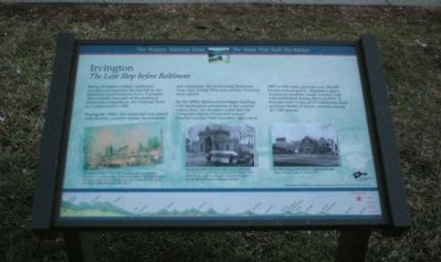
The Last Stop before Baltimore
— The Historic National Road - The Road That Built The Nation —
During the 1800s, this landscape was dotted with taverns, summer estates, monasteries and cemeteries, all overlooking Baltimore. From that, Irving Ditty laid out this Victorian style suburb.
By the 1830s, Baltimoreans began building vast landscaped cemeteries in the country where busy city dwellers could find the “eloquent silence of God and nature.” Nearby Loudon Park Cemetery, laid out in 1853 on 365 acres, now has over 200,000 burials including H.L. Mencken’s grave. A national cemetery inside Loudon Park was established during the Civil War. It includes both Union and Confederate dead and four Medal of Honor winners among its 7,000 graves.
Erected by America's Byways.
Topics and series. This historical marker is listed in this topic list: Roads & Vehicles. In addition, it is included in the The Historic National Road series list. A significant historical year for this entry is 1806.
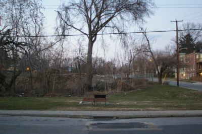
Location. 39° 16.909′ N, 76° 41.218′ W. Marker is in Baltimore, Maryland. It is in Irvington. Marker is at the intersection of Frederick Avenue (Maryland Route 144) and Woodington Road on Frederick Avenue. Touch for map. Marker is in this post office area: Baltimore MD 21229, United States of America. Touch for directions.
Other nearby markers. At least 8 other markers are within walking distance of this marker. The Citizens of Irvington (about 600 feet away, measured in a direct line); Confederate Soldiers Memorial (approx. 0.4 miles away); Harry Gilmor Monument (approx. 0.4 miles away); Mary Pickersgill (approx. 0.4 miles away); Weiskittel Mausoleum (approx. half a mile away); Address by President Lincoln (approx. 0.6 miles away); Loudon Park National Cemetery (approx. 0.6 miles away); A National Cemetery System (approx. 0.6 miles away). Touch for a list and map of all markers in Baltimore.
More about this marker. On the lower left is a painting depicting "Fairview Inn or Three Mile House, only three miles from Baltimore, was a lively stop during the heyday of the National Road. The Inn is gone but an original stone mile marker still sits on the lawn of the Memorial Methodist Church." This painting is reproduced as the background on the marker, and is the standard for the set.
A photo in the lower center is captioned, "During the 1880s, thousands more came out on weekends to visit the graves of loved ones and picnic in Loudon Park Cemetery. In 1905, a trolley line transported visitors through the cemetery's picturesque grounds."
On
the lower right a photo illustrates, "By 1926, Irvington thrived as a neighborhood main street, complete with its own theater."
An elevation diagram of the national road is displayed on the bottom of the marker's face.
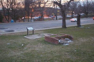
Regarding Irvington. The brick and concrete structure immediately behind the marker, which appears to be significant, as this plot of land has not been cleared for development like the land around it, is not mentioned in any way on the sign.
Also see . . . Irvington, Baltimore. Wikipedia entry (Submitted on January 20, 2021, by Larry Gertner of New York, New York.)
Additional commentary.
1. Dorsey Lane
There was a street that is now Caton Ave, but was then called Dorsey Lane as late as 1895 in this area. It is sanwiched between Frederick and Allendale, and behind the unit block of South Hilton St. My great grandmother lived at #15 Dorsey Lane. My family is African American. I would like to know the type of dwellings that were there for African Americans at that time. I’m thinking they were former slaves. Their names were, Anna Carroll, born 1835; Mary Carroll (became Mary Rogers), born 1857; Ella Rogers, born 1892, who married Ransom Sutton. The family lived in the area for many years. I would
like any info on the African Americans’ social and economic conditions during that time. Mary Carroll married Williams Rogers and they had 10 children while living at #15 Dorsey Lane.
— Submitted February 2, 2008, by Helen Agent of Gwynn Oak, Maryland.
Credits. This page was last revised on March 24, 2024. It was originally submitted on January 24, 2008, by Christopher Busta-Peck of Shaker Heights, Ohio. This page has been viewed 2,243 times since then and 27 times this year. Last updated on March 3, 2018, by Devry Becker Jones of Washington, District of Columbia. Photos: 1, 2, 3. submitted on January 24, 2008, by Christopher Busta-Peck of Shaker Heights, Ohio. • Bill Pfingsten was the editor who published this page.


