Near Freedom in Beaver County, Pennsylvania — The American Northeast (Mid-Atlantic)
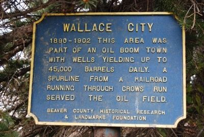
Wallace City
Erected by Beaver County Historical Research & Landmarks Foundation.
Topics and series. This historical marker is listed in this topic list: Notable Places. In addition, it is included in the Pennsylvania - Beaver County Historical Research and Landmarks Foundation series list.
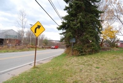
Location. 40° 40.315′ N, 80° 11.614′ W. Marker is near Freedom, Pennsylvania, in Beaver County. Marker is at the intersection of Dunlap Hill Road (Pennsylvania Route 989) and Ridgewood Drive, on the right when traveling north on Dunlap Hill Road. Touch for map. Marker is in this post office area: Freedom PA 15042, United States of America. Touch for directions.
Other nearby markers. At least 8 other markers are within 4 miles of this marker, measured as the crow flies. Conway Railroad Yards (approx. 2˝ miles away); Vicary House (approx. 3.1 miles away); Trinity Evangelical Lutheran (approx. 3.2 miles away); St. Peter's Lutheran Church (approx. 3.2 miles away); Saint Matthew's Church (approx. 3.2 miles away); Freedom Boat Yards (approx. 3.2 miles away); Boyhood Home of Henry Mancini (approx. 3.4 miles away); Logstown (approx. 3.6 miles away). Touch for a list and map of all markers in Freedom.
More about this marker. Marker is hidden amongst pine trees, not easy to see.
Also see . . . Beaver County Historical Research and Landmarks Foundation. Foundation website homepage (Submitted on November 13, 2011, by Mike Wintermantel of Pittsburgh, Pennsylvania.)
Credits. This page was last revised on August 4, 2022. It was originally submitted on November 11, 2011, by Mike Wintermantel of Pittsburgh, Pennsylvania. This page has been viewed 1,225 times since then and 82 times this year. Photos: 1, 2. submitted on November 11, 2011, by Mike Wintermantel of Pittsburgh, Pennsylvania.

