Near Amissville in Rappahannock County, Virginia — The American South (Mid-Atlantic)
Gaines's Crossroads
“The Animal Must Be Very Slim”
— Gettysburg Campaign —
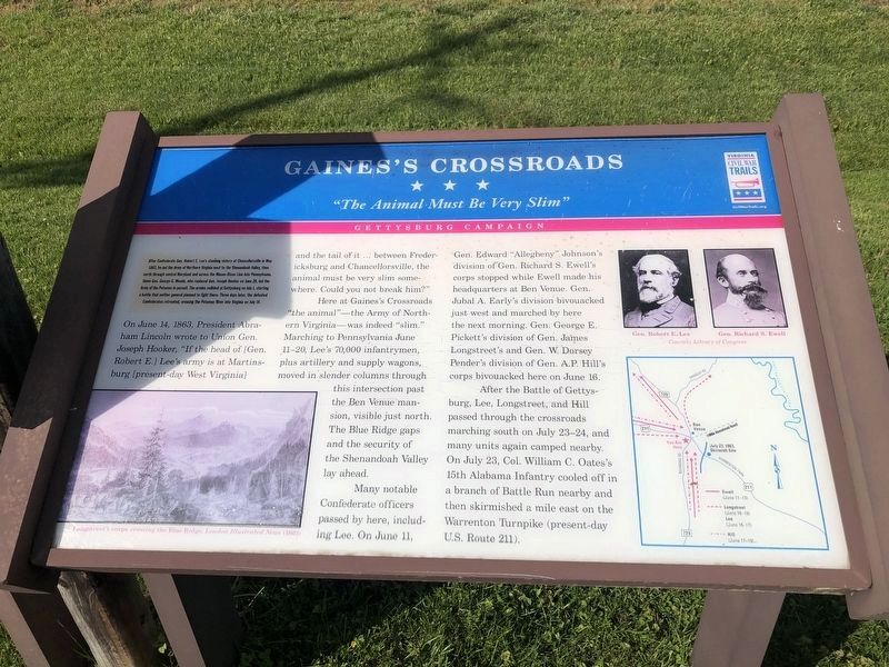
After Confederate Gen. Robert E. Lee’s stunning victory at Chancellorsville in May 1863, he led the Army of Northern Virginia west to the Shenandoah Valley, then north through central Maryland and across the Mason-Dixon Line into Pennsylvania. Union Gen. George G. Meade, who replaced Gen. Joseph Hooker on Jun 28, led the Army of the Potomac in pursuit. The armies collided at Gettysburg on July 1, starting a battle that neither general planned to fight there. Three days later, the defeated Confederates retreated, crossing the Potomac River into Virginia on July 14.
On June 14, 1863, President Abraham Lincoln wrote to Union Gen. Joseph Hooker, “If the head of [Gen. Robert E.] Lee’s army is at Martinsburg [present-day West Virginia] and the tail of it … between Fredericksburg and Chancellorsville, the animal must be very slim somewhere. Could you not break him?”
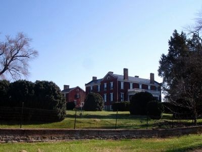
Here at Gaines’s Crossroads “the animal”—the Army of Northern Virginia—was indeed “slim.” Marching to Pennsylvania June 11-20, Lee’s 70,000 infantrymen, plus artillery and supply wagons, moved in slender columns through this intersection past the Ben Venue mansion, visible just north. The Blue Ridge gaps and the security of the Shenandoah Valley lay ahead.
Many notable Confederate officers passed by here, including Lee. On June 11, Gen. Edward “Allegheny” Johnson’s division of Gen. Richard S. Ewell’s corps stopped while Ewell made his headquarters at Ben Venue. Gen. Jubal A. Early’s division bivouacked just west and marched by here the next morning. Gen. George E. Pickett’s division of Gen. James Longstreet’s and Gen. W. Dorsey Pender’s division of Gen. A.P. Hill’s corps bivouacked here on June 16.
After the Battle of Gettysburg, Lee, Longstreet, and Hill passed through the crossroads marching south on July 23-24, and many units again camped nearby. On July 23, Col. William C. Oates’s 15th Alabama Infantry cooled off in a branch of Battle Run nearby and then skirmished a mile east on the Warrenton Turnpike (present-day U.S. Route 211).
Erected by Virginia Civil War Trails.
Topics and series. This historical marker is listed in this topic list: War, US Civil. In addition, it is included in the Virginia Civil War Trails series list. A significant historical month for this entry is May 1863.
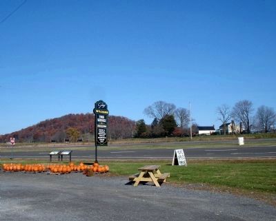
Location. 38° 43.145′ N, 78° 4.034′ W. Marker is near Amissville, Virginia, in Rappahannock County. Marker is at the intersection of Lee Highway (U.S. 211) and Richmond Road (Virginia Route 729), on the right when traveling east on Lee Highway. Marker is in the parking lot of Williams

Photographed By Devry Becker Jones (CC0), May 8, 2021
2. Gaines’s Crossroads Marker
The marker has slightly weathered.
Other nearby markers. At least 8 other markers are within 5 miles of this marker, measured as the crow flies. Twilight of Slavery (here, next to this marker); Albert Gallatin Willis (approx. 3.6 miles away); Flint Hill Baptist Church (approx. 3.6 miles away); Campaign of Second Manassas (approx. 4.1 miles away); Hinson's Ford (approx. 4.2 miles away); The Rappahannock Old Guard (approx. 4.3 miles away); Rappahannock People Before and During the Civil War (approx. 4.3 miles away); Rappahannock County in the Civil War (approx. 4.3 miles away). Touch for a list and map of all markers in Amissville.
More about this marker. On the lower left of the marker is a sketch captioned Longstreet's corps crossing the Blue Ridge, London Illustrated News (1863). On the upper right of the marker are two photos captioned Gen. Robert E. Lee and Gen. Richard S. Ewell Courtesy Library of Congress. On the lower right of the marker is a map of the area around Gaines's Crossroads indicating troop movements.
Also see . . . Ben Venue. National Register of Historic Places Nomination Form (.pdf). (Submitted on November 12, 2011.)
Credits. This page was last revised on May 10, 2021. It was originally submitted on November 12, 2011. This page has been viewed 1,886 times since then and 68 times this year. Photos: 1. submitted on November 12, 2011. 2. submitted on May 10, 2021, by Devry Becker Jones of Washington, District of Columbia. 3, 4. submitted on November 12, 2011. • Craig Swain was the editor who published this page.


