Paducah in McCracken County, Kentucky — The American South (East South Central)
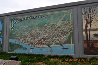
Paducah 1873 "Bird's Eye View"
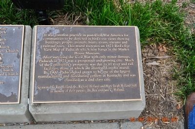
After surviving the Civil War with only minor damage, Paducah in 1873 was a prosperous and growing city. Much of the community's prosperity was due to its river and rail facilities, many of which are illustrated in this mural. By 1900, Paducah had grown to be one of the largest manufacturing and distributing centers in Kentucky and was classified as a 2nd class city.
Marker 2
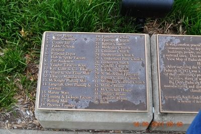
1. Court House
2. Male Seminary
3. County Jail
4. Public Schools
5. Hospital
6. Railroad Pres. Church
7. Hub & Spoke factory
8. Fort Anderson
9. Vaughn Tobacco Whrs.
10. Kay, Cobb & Co. Tobacco
11. Allard & Son Flour Mill Episcopal
12. Tobacco Manufactory
13. McKnight Planing Mill Church
14. Langstaff, Orm Planing & Sawmill Colored Church
15. Marine Ways
16. Linning & Jackson Factory
17. Rolling Mill
18. Phoenix Foundry
19. Furniture Factory
20. Episcopal Church
21. Baptist Church
22. Methodist Church
23. Christian Church
24. Presbyterian Church
25. Cumberland
26. Lutheran Church
27. Catholic Church
28. Jewish Synagogue
29. N. Methodist
30. Baptist Colored
31. Methodist
32. Market House
33. McCutchen House
34. Smedley House
35. Langstaff House
36. Bank
Erected by Rex Holland, Jr., Richard Holland and Mary Leigh Holland Stiff in memory of their parents, Dr. Rex and Jane C. Holland.
Topics. This historical marker is listed in this topic list: War, US Civil. A significant historical year for this entry is 1873.
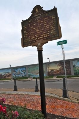
Location. 37° 5.308′ N, 88° 35.655′ W. Marker is in Paducah, Kentucky, in McCracken County. Marker is on North Water Street. This mural is between Paducah architecture reflected the settlers' different religious faiths and first log cabin. Touch for map. Marker is in this post office area: Paducah KY 42001, United States of America. Touch for directions.
Other nearby markers. At least 8 other markers are within walking distance of this marker. Paducah's Architecture (here, next to this marker); Robert S. Davis (here, next to this marker); Paducah's River Industry (a few steps from this marker); Union Gen. U.S. Grant (a few steps from this marker); First Log Cabin / First Frame House (a few steps from this marker); "Market" (within shouting distance of this marker); The August 8th Emancipation Celebration at Stuart Nelson Park (within shouting distance of this marker); Federal Occupation of Paducah (within shouting distance of this marker). Touch for a list and map of all markers in Paducah.
Credits. This page was last revised on September 25, 2023. It was originally submitted on November 21, 2011, by Sandra Hughes Tidwell of Killen, Alabama, USA. This page has been viewed 678 times since then and 40 times this year. Last updated on September 24, 2023, by Carl Gordon Moore Jr. of North East, Maryland. Photos: 1, 2, 3, 4, 5. submitted on November 21, 2011, by Sandra Hughes Tidwell of Killen, Alabama, USA. • J. Makali Bruton was the editor who published this page.
