Near Lee Vining in Mono County, California — The American West (Pacific Coastal)
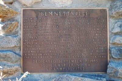
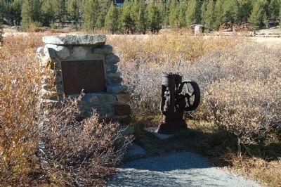
Bennettville
Erected 1985 by E Clampus Vitus, Bodie Chapter No. 64.
Topics and series. This historical marker is listed in these topic lists: Natural Resources • Roads & Vehicles. In addition, it is included in the E Clampus Vitus series list. A significant historical year for this entry is 1874.
Location. 37° 56.306′ N, 119° 15.028′ W. Marker is near Lee Vining, California, in Mono County. Marker can be reached from the intersection of Saddlebags Lake Road and Tioga Pass Road (California Highway 120), on the right when traveling east. Saddlebags Lake Road is 7 miles west of Lee Vining and 1 mile east of the Yosemite National Park entrance. Touch for map. Marker is in this post office area: Lee Vining CA 93541, United States of America. Touch for directions.
Other nearby markers. At least 8 other markers are within 8 miles of this marker, measured as the crow flies. The Tioga Pass Road (approx. 1.2 miles away); Would-Be Miners and Occasional Tourists (approx. 1.2 miles away); a different marker also named Tioga Pass Road (approx. 2 miles away); Yosemite Ghost Mines (approx. 3.3 miles away); Lundy (approx. 6.2 miles away); Sheriff James P. Dolan (approx. 6.9 miles away); Grave of Adeline Carson Stilts (approx. 7.1 miles away); Lee Vining (approx. 7.3 miles away). Touch for a list and map of all markers in Lee Vining.
Regarding Bennettville. Ruins of the mining town still remain and are accessible by a walk of about 15 minutes from the nearby campground. Site is only accessible during the summer months.
Also see . . .
1. Bennettville. History of Bennettville along with current photos of the site. (Submitted on December 1, 2011.)
2. Bennittville. From Ghost Mines of Yosemite (1958) by Douglass Hubbard:
Of the dozen or more buildings which once graced Bennettville only two remain today— the old stable and what probably was the assay office. In the shadow of Mount Dana they have weathered quietly to a golden brown. Burned wood outlines the foundations of the company office and a large warehouse. The fate of the other buildings is not known. (Submitted on December 1, 2011.)
Credits. This page was last revised on June 16, 2016. It was originally submitted on November 29, 2011, by Barry Swackhamer of Brentwood, California. This page has been viewed 670 times since then and 14 times this year. Photos: 1, 2, 3, 4. submitted on November 29, 2011, by Barry Swackhamer of Brentwood, California. • Syd Whittle was the editor who published this page.
Editor’s want-list for this marker. Photos of the buildings and mine ruins. • Can you help?


