Near Coleville in Mono County, California — The American West (Pacific Coastal)
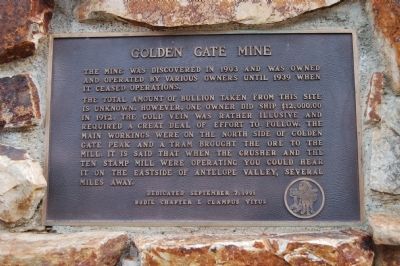
Golden Gate Mine
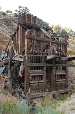
The total amount of bullion taken from this site is unknown. However, one owner did ship $12,000.00 in 1912. The gold vein was rather illusive and required a great deal of effort to follow. The main workings were on the north side of Golden Gate Peak and a tram brought the ore to the mill. It is said that when the crusher and the ten stamp mill were operating you could hear it on the east side of Antelope Valley, several miles away.
Erected 1991 by E Clampus Vitus, Bodie Chapter No. 64.
Topics and series. This historical marker is listed in these topic lists: Industry & Commerce • Natural Resources. In addition, it is included in the E Clampus Vitus series list. A significant historical year for this entry is 1903.
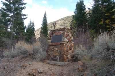
Location. 38° 30.84′ N, 119° 31.897′ W. Marker is near Coleville, California, in Mono County. Marker is on Golden Gate Road near Three Flags Highway (California Highway 395). From Highway 395, half-way between Walker and Coleville, turn west on Mill Canyon Road. Keep right onto Golden Gate Road. The marker is approximately 3 miles from Highway 395. The marker is across the road from the stamp mill. Touch for map . Marker is in this post office area: Coleville CA 96107, United States of America. Touch for directions.
Other nearby markers. At least 8 other markers are within 14 miles of this marker, measured as the crow flies. A different marker also named Golden Gate Mine (a few steps from this marker); The C-130 Crew (approx. 2.6 miles away); Flag on Centennial Bluff (approx. 3.1 miles away); Coleville (approx. 4 miles away); Topaz Post Office (approx. 6.4 miles away); Mountain Warfare Training Center (approx. 10.9 miles away); Sonora Mono Toll Road (approx. 14 miles away); Sonora Pass (approx. 14 miles away). Touch for a list and map of all markers in Coleville.
Also see . . . The Golden Gate Mine. (Submitted on December 1, 2011, by Barry Swackhamer of Brentwood, California.)
Credits. This page was last revised on June 16, 2016. It was originally submitted on December 1, 2011, by Barry Swackhamer of Brentwood, California. This page has been viewed 1,171 times since then and 21 times this year. Photos: 1, 2, 3. submitted on December 1, 2011, by Barry Swackhamer of Brentwood, California. • Syd Whittle was the editor who published this page.


