Marker Logo HMdb.org THE HISTORICAL
MARKER DATABASE
“Bite-Size Bits of Local, National, and Global History”
Marietta in Cobb County, Georgia — The American South (South Atlantic)
 

Cherokee Indian Trail Tree


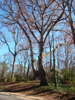
Cherokee Indian Trail Tree Marker image. Click for full size.
Photographed By Judith Barber, December 1, 2011
1. Cherokee Indian Trail Tree Marker
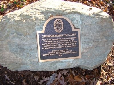
Inscription. The Native Americans bent saplings to grow into living “signposts” for traveling Indians. These living markers pointed the way to a water source, a suitable river crossing or a main trail.
 
Erected 2010 by Nicholas Wallingford Chapter National Society Colonial Dames XVII Century.
 
Topics and series. This historical marker is listed in this topic list: Native Americans. In addition, it is included in the The Colonial Dames XVII Century, National Society series list.
 
Location. 33° 58.071′ N, 84° 33.803′ W. Marker is in Marietta, Georgia, in Cobb County. Marker is on St. Anns Road. Touch for map. Marker is at or near this postal address: 663 St Anns Road, Marietta GA 30064, United States of America. Touch for directions.
 
Other nearby markers. At least 8 other markers are within walking distance of this marker. "Oakton" (about 700 feet away, measured in a direct line); Oil House Location (approx. 0.6 miles away); Forge Location (approx. 0.6 miles away); Civilian Conservation Corps Camp (approx. 0.7 miles away); Barracks Location (approx. 0.7 miles away); Education Building Location (approx. 0.7 miles away); Tool House Location (approx. 0.7 miles away); Residence of Alice McLellan Birney (approx. 0.7 miles away). Touch for a list and map of all markers in Marietta.
 
Paid Advertisement
Click on the ad for more information.
Please report objectionable advertising to the Editor.
Click or scan to see
this page online
Cherokee Indian Trail Tree Marker image. Click for full size.
Photographed By Judith Barber, December 1, 2011
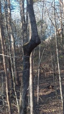
2. Cherokee Indian Trail Tree Marker
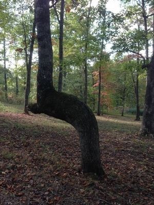
The trail tree with bent limb.
Cherokee Indian Trail Tree Marker image. Click for full size.
Photographed By Judith Barber, December 1, 2011
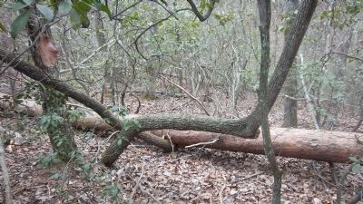
3. Cherokee Indian Trail Tree Marker
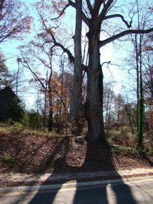
Another view of the trail tree.
Cherokee Indian Trail Tree image. Click for full size.
Photographed By Judy Menzies, February 28, 2013
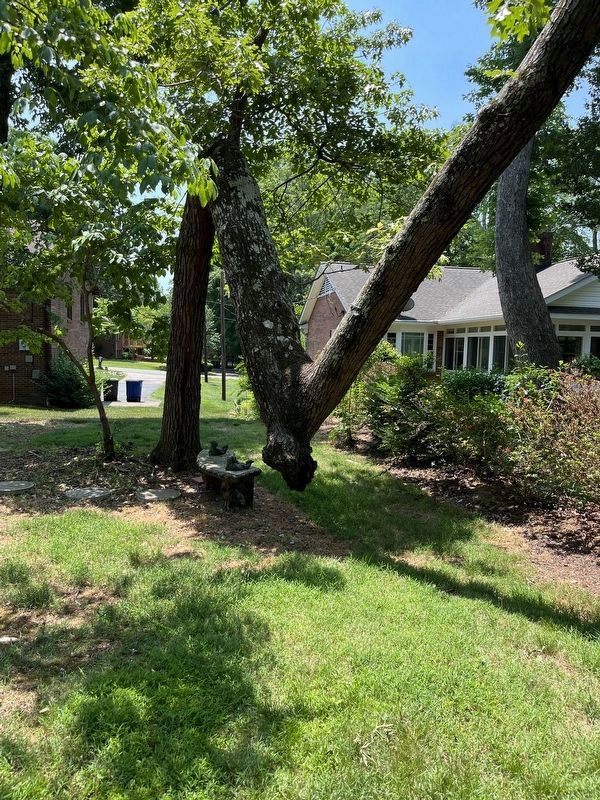
4. Cherokee Indian Trail Tree
This is one of several Trail Tree markers found on Ivy Mountain just off Hwy. 197 north of Clarkesville, GA. All of the trees we found are facing 120 degrees S, SE.
Cherokee Indian Trail Tree image. Click for full size.
Photographed By Judy Menzies, February 282013
5. Cherokee Indian Trail Tree
This tree is located on Ivy Mountain just off Hwy. 197 north of Clarkesville, GA. This tree is one of several trail trees in this area.
Cherokee Indian Trail Tree image. Click for full size.
Photographed By Mickey Cowan Reavis
6. Cherokee Indian Trail Tree
This tree was on the Atwood Dairy Farm land.
unmarked Cherokee Indian Trail Tree image. Click for full size.
Photographed By Steven Olson, October 17, 2015
7. unmarked Cherokee Indian Trail Tree
 
 
Credits. This page was last revised on March 3, 2023. It was originally submitted on December 5, 2011, by Judith Barber of Marietta, Georgia. This page has been viewed 4,204 times since then and 111 times this year. Photos:   1, 2, 3. submitted on December 5, 2011, by Judith Barber of Marietta, Georgia.   4, 5. submitted on March 1, 2013, by Judy Menzies of Clarkesville, Georgia.   6. submitted on February 27, 2023, by Mickey Cowan Reavis of Winston-Salem, Nc 27103.   7. submitted on October 17, 2015, by Steven Olson of Hayesville, North Carolina. • Craig Swain was the editor who published this page.
Share this page.  
Share on Tumblr
m=50200

CeraNet Cloud Computing sponsors the Historical Marker Database.
This website earns income from purchases you make after using our links to Amazon.com. We appreciate your support.
Paid Advertisement
Apr. 24, 2024