Orange in Orange County, California — The American West (Pacific Coastal)
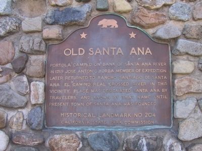
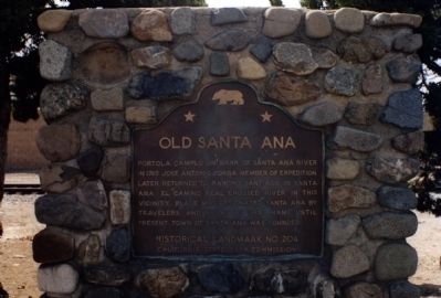
Old Santa Ana
Erected by California State Park Commission. (Marker Number 204.)
Topics and series. This historical marker is listed in these topic lists: Exploration • Hispanic Americans. In addition, it is included in the California Historical Landmarks, the El Camino Real, “The King's Highway” (California), and the Portolá Expedition series lists. A significant historical year for this entry is 1769.
Location. 33° 50.2′ N, 117° 50.778′ W. Marker is in Orange, California, in Orange County. Marker is at the intersection of North Orange Olive Road and East Lincoln Avenue, on the right when traveling south on North Orange Olive Road. Touch for map. Marker is at or near this postal address: 2898 North Orange Olive Road, Orange CA 92865, United States of America. Touch for directions.
Other nearby markers. At least 8 other markers are within 2 miles of this marker, measured as the crow flies. First Site of the Olive Mill (approx. half a mile away); Dwight David Eisenhower (approx. half a mile away); Steve Ambriz Memorial Park (approx. 0.6 miles away); Campsite of Anza (approx. 0.7 miles away); Block by Block (approx. 0.9 miles away); a different marker also named Block by Block (approx. 0.9 miles away); a different marker also named Block by Block (approx. 0.9 miles away); Boeing Autonetics (approx. 1.2 miles away). Touch for a list and map of all markers in Orange.
More about this marker. This site has been designated as California Registered Historical Landmark No. 204.
Credits. This page was last revised on June 16, 2016. It was originally submitted on December 9, 2011, by Michael Kindig of Elk Grove, California. This page has been viewed 1,998 times since then and 77 times this year. Photos: 1, 2. submitted on December 9, 2011, by Michael Kindig of Elk Grove, California. • Syd Whittle was the editor who published this page.

