Cape Elizabeth in Cumberland County, Maine — The American Northeast (New England)
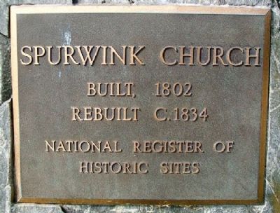
Spurwink Church
Built, 1802
Rebuilt C.1834
National Register of
Historic Sites
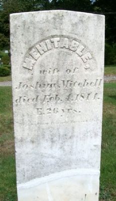
Topics. This historical marker is listed in these topic lists: Cemeteries & Burial Sites • Churches & Religion. A significant historical year for this entry is 1802.
Location. 43° 34.781′ N, 70° 15.096′ W. Marker is in Cape Elizabeth, Maine, in Cumberland County. Marker is at the intersection of Bowery Beach Road (Maine Route 77) and Spurwink Road (Maine Route 77), on the right when traveling north on Bowery Beach Road. Touch for map. Marker is at or near this postal address: 533 Spurwink Ave, Cape Elizabeth ME 04107, United States of America. Touch for directions.
Other nearby markers. At least 8 other markers are within 4 miles of this marker, measured as the crow flies. Bachelor's Officers' Quarters (approx. 3˝ miles away); Bachelor Officers' Quarters (approx. 3˝ miles away); Field Officer's Quarters (approx. 3˝ miles away); a different marker also named Field Officer's Quarters (approx. 3˝ miles away); Gun Shed (approx. 3˝ miles away); a different marker also named Gun Shed (approx. 3˝ miles away); Militia Storehouse (approx. 3˝ miles away); a different marker also named Militia Storehouse (approx. 3˝ miles away). Touch for a list and map of all markers in Cape Elizabeth.
Also see . . . 2010 Article on Restoration in Portland Press Herald . (Submitted on December 10, 2011, by William Fischer, Jr. of Scranton, Pennsylvania.)
Credits. This page was last revised on November 22, 2021. It was originally submitted on December 10, 2011, by William Fischer, Jr. of Scranton, Pennsylvania. This page has been viewed 723 times since then and 19 times this year. Photos: 1, 2, 3, 4, 5. submitted on December 10, 2011, by William Fischer, Jr. of Scranton, Pennsylvania.
