Marker Logo HMdb.org THE HISTORICAL
MARKER DATABASE
“Bite-Size Bits of Local, National, and Global History”
Pensacola in Escambia County, Florida — The American South (South Atlantic)
 

Pensacola Lighthouse


Pensacola Lighthouse Marker image. Click for full size.
Photographed By Sandra Hughes, December 7, 2011
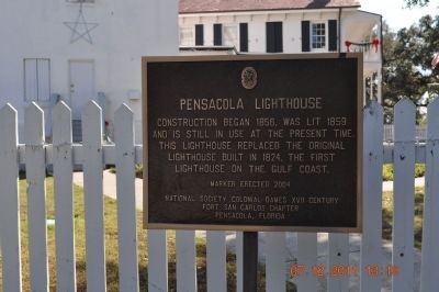
1. Pensacola Lighthouse Marker
Inscription. Construction began 1856, was lit 1859 and is still in use at the present time. This lighthouse replaced the original lighthouse built 1824, the first lighthouse on the Gulf Coast.
 
Erected 2004 by National Society Colonial Dames XVII Century Fort San Carlos Chapter Pensacola, Florida.
 
Topics and series. This historical marker is listed in these topic lists: CommunicationsWaterways & Vessels. In addition, it is included in the Lighthouses, and the The Colonial Dames XVII Century, National Society series lists. A significant historical year for this entry is 1856.
 
Location. 30° 20.76′ N, 87° 18.49′ W. Marker is in Pensacola, Florida, in Escambia County. Located across the street from the National Aviation Museum. You have to go through military gate to gain access. Touch for map. Marker is at or near this postal address: 2081 Radford Blvd, Pensacola FL 32508, United States of America. Touch for directions.
 
Other nearby markers. At least 8 other markers are within walking distance of this marker. Pelicans In Paradise (about 500 feet away, measured in a direct line); USS Antietam (CV-36) Anchor (approx. 0.3 miles away); USS Essex (CV-9) Anchor (approx. 0.3 miles away); Pensacola’s First Lighthouse (approx. 0.4 miles away); The Cradle of Naval Aviation (approx. 0.4 miles away); The National Flight Academy
Paid Advertisement
Click on the ad for more information.
Please report objectionable advertising to the Editor.
Click or scan to see
this page online
(approx. 0.4 miles away); Resisting Land-based Assaults (approx. 0.9 miles away); Spain to Pensacola (approx. one mile away). Touch for a list and map of all markers in Pensacola.
 
Pensacola Lighthouse and Marker image. Click for full size.
Photographed By Sandra Hughes, December 7, 2011
2. Pensacola Lighthouse and Marker
The marker is along the fence to the right in this view.
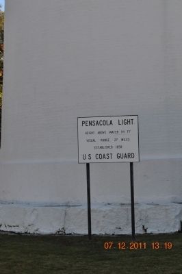
Pensacola Lighthouse Marker image. Click for full size.
Photographed By Sandra Hughes, December 7, 2011
3. Pensacola Lighthouse Marker
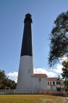
Pensacola Light
Height above water 191 ft
Visual range 27 miles
Established 1858
U.S. Coast Guard
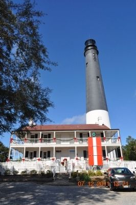
Pensacola Lighthouse Marker image. Click for full size.
Photographed By Sandra Hughes, December 7, 2011
4. Pensacola Lighthouse Marker
Front view facing the gulf
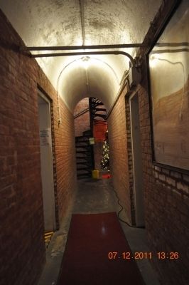
Pensacola Lighthouse Marker image. Click for full size.
Photographed By Sandra Hughes, December 7, 2011
5. Pensacola Lighthouse Marker
Entrance way to stairway of lighthouse. The day I was there it was a wind advisory (winds in excess of 35 mph) no one could climb the stairs to the top.
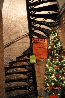
Pensacola Lighthouse Marker image. Click for full size.
Photographed By Sandra Hughes, December 7, 2011
6. Pensacola Lighthouse Marker
Staircase to the lighthouse. Warning climb at your own risk. 177 Steps
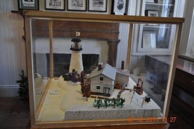
Pensacola Lighthouse Miniature image. Click for full size.
Photographed By Sandra Hughes, December 7, 2011
7. Pensacola Lighthouse Miniature
 
 
Credits. This page was last revised on August 20, 2020. It was originally submitted on December 12, 2011, by Sandra Hughes Tidwell of Killen, Alabama, USA. This page has been viewed 960 times since then and 21 times this year. Photos:   1, 2, 3, 4, 5, 6, 7. submitted on December 12, 2011, by Sandra Hughes Tidwell of Killen, Alabama, USA. • Craig Swain was the editor who published this page.
Share this page.  
Share on Tumblr
m=50405

CeraNet Cloud Computing sponsors the Historical Marker Database.
This website earns income from purchases you make after using our links to Amazon.com. We appreciate your support.
Paid Advertisement
Apr. 24, 2024