Buckhead in Atlanta in Fulton County, Georgia — The American South (South Atlantic)
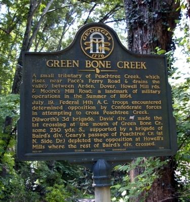
Green Bone Creek
A small tributary of Peachtree Creek, which rises near Pace’s Ferry Road & drains the valley between Arden, Dover, Howell Mill rds. & Moore’s Mill Road; a landmark of military operations in the Summer of 1864.
July 19. Federal 14th A.C. troops encountered determined opposition by Confederate forces in attempting to cross Peachtree Creek.
Dilworth’s 3d brigade, Davis div. [US] made the 1st crossing at the month of Green Bone Cr., some 250 yds. S., supported by a brigade of Baird´s div. Geary’s passage of Peachtree Cr. (at N. Side Dr.) depleted the opposition at Howell’s Mills where the rest of Baird's div. crossed.
Erected 1955 by Georgia Historical Commission. (Marker Number 060-54.)
Topics and series. This historical marker is listed in this topic list: War, US Civil. In addition, it is included in the Georgia Historical Society series list. A significant historical month for this entry is July 1784.
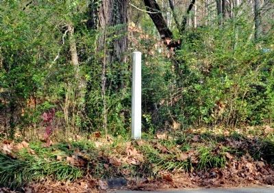
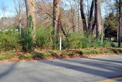
Location. Marker has been reported missing. It was located near 33° 49.559′ N, 84° 25.625′ W. Marker was in Atlanta, Georgia, in Fulton County. It was in Buckhead. Marker was on Peachtree Battle Avenue, 0.1 miles east of Bohler Road NW, on the left when traveling east. Touch for map. Marker was in this post office area: Atlanta GA 30309, United States of America. Touch for directions.
Other nearby markers. At least 8 other markers are within one mile of this location, measured as the crow flies. Federal Crossings (approx. 0.7 miles away); Reynold’s Brigade (approx. 0.7 miles away); Howell's Mills (approx. 0.7 miles away); Disputed Passage (approx. 0.8 miles away); Moore's Mill (approx. 0.9 miles away); Battle at Moore’s Mill (approx. 0.9 miles away); Geary’s Div. to Peachtree Creek (approx. one mile away); Rt. Of 20th A.C. Line (approx. one mile away). Touch for a list and map of all markers in Atlanta.
Regarding Green Bone Creek. The movements described on this marker were part of the Battle of Peachtree Creek, General John Bell Hood's first action after being given command of the Army of Tennessee replacing General Joseph E. Johnston.
Also see . . .
1. Battle of Peachtree Creek. Wikipedia entry (Submitted on February 19, 2021, by Larry Gertner of New York, New York.)
2. Gone and forgotten?. Atlanta Journal-Constitution article, December 3, 2014:
Lack of funding had prevented replacement of this plaque as of late 2014. (Submitted on February 19, 2021, by Larry Gertner of New York, New York.)
Credits. This page was last revised on February 8, 2023. It was originally submitted on February 23, 2009, by David Seibert of Sandy Springs, Georgia. This page has been viewed 1,595 times since then and 26 times this year. Last updated on December 14, 2011, by David Seibert of Sandy Springs, Georgia. Photos: 1. submitted on February 23, 2009, by David Seibert of Sandy Springs, Georgia. 2, 3. submitted on December 14, 2011, by David Seibert of Sandy Springs, Georgia. • Craig Swain was the editor who published this page.


