Elkhorn City in Pike County, Kentucky — The American South (East South Central)
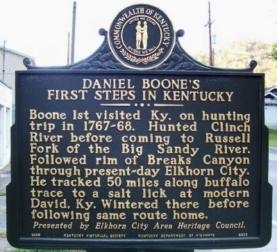
Daniel Boone's First Steps in Kentucky
Presented by Elkhorn City Area Heritage Council.
Erected 2008 by Kentucky Historical Society and Kentucky Department of Highways. (Marker Number 2203.)
Topics and series. This historical marker is listed in this topic list: Exploration. In addition, it is included in the Kentucky Historical Society series list.
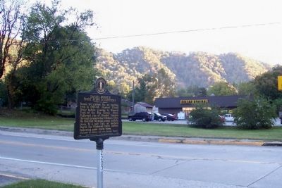
Location. 37° 18.319′ N, 82° 21.254′ W. Marker is in Elkhorn City, Kentucky, in Pike County. Marker is on Center Street (Kentucky Route 80) south of Elkhorn Street (Kentucky Route 80), on the left when traveling south. Touch for map. Marker is in this post office area: Elkhorn City KY 41522, United States of America. Touch for directions.
Other nearby markers. At least 8 other markers are within 4 miles of this marker, measured as the crow flies. Elkhorn City’s Railroads (about 700 feet away, measured in a direct line); William Ramey (approx. 0.2 miles away); Richard Potter (approx. half a mile away); Russell Fork Overlook (approx. 1.8 miles away); Known But to God (approx. 2.3 miles away); Clinchfield Overlook (approx. 3 miles away in Virginia); The Name Breaks (approx. 3.1 miles away in Virginia); Early Settlement (approx. 3˝ miles away in Virginia). Touch for a list and map of all markers in Elkhorn City.
Credits. This page was last revised on June 16, 2016. It was originally submitted on December 18, 2011, by Forest McDermott of Masontown, Pennsylvania. This page has been viewed 1,628 times since then and 61 times this year. Photos: 1, 2, 3. submitted on December 18, 2011, by Forest McDermott of Masontown, Pennsylvania. • Bernard Fisher was the editor who published this page.


