Yucaipa in San Bernardino County, California — The American West (Pacific Coastal)
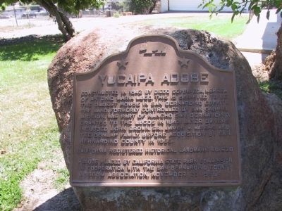
Yucaipa Adobe
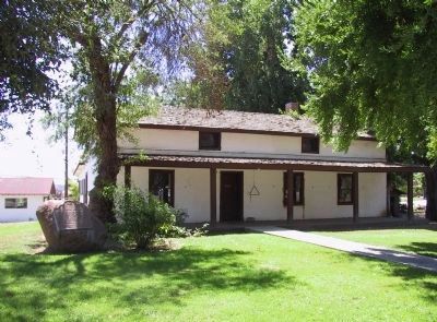
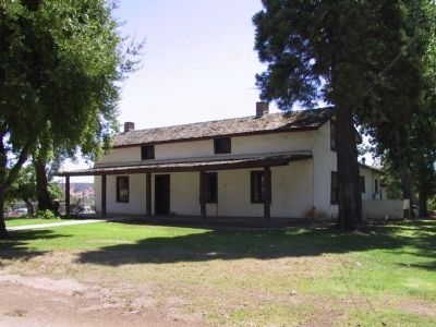
Constructed in 1842 by Diego Sepulveda, nephew of Antonio Maria Lugo, this is believed to be the oldest house in San Bernardino County. The land, formerly controlled by San Gabriel Mission, was part of Rancho San Bernardino, granted to the Lugos in 1842. Later owners included John Brown, Sr., James W. Waters, and the Dunlap Family before acquisition by San Bernardino County in 1955.
Erected 1958 by California State Park Commission in cooperation with the San Bernardino County Museum Association. (Marker Number 528.)
Topics and series. This historical marker is listed in these topic lists: Hispanic Americans • Notable Buildings • Settlements & Settlers. In addition, it is included in the California Historical Landmarks series list. A significant historical year for this entry is 1842.
Location. 34° 1.345′ N, 117° 6.12′ W. Marker is in Yucaipa, California, in San Bernardino County. Marker is at the intersection of Kentucky Street and Dunlap Boulevard, on the right when traveling east on Kentucky Street. Touch for map. Marker is at or near this postal address: 32183 Kentucky Street, Yucaipa CA 92399, United States of America. Touch for directions.
Other nearby markers. At least 8 other markers are within 6 miles of this marker, measured as the crow flies. Yucaipa Rancheria (within shouting distance of this marker); The Greenspot Market (approx. 3.4 miles away); Mill Creek Zanja (approx. 3.8 miles away); Kimberly Crest (approx. 4.3 miles away); a different marker also named Mill Creek Zanja (approx. 4.6 miles away); Camp Mill Creek (approx. 5 miles away); Lincoln Memorial Shrine (approx. 5.2 miles away); William McKinley (approx. 5.2 miles away).
Regarding Yucaipa Adobe. It is now believed that Diego Sepulveda’s adobe was located a few hundred yards away, near 16th and Dunlap Boulevard, and that James Waters, noted hunter, trapper, and mountaineer, built the Yucaipa Adobe in 1858. John Dunlap purchased the Yucaipa ranch in 1869. The Dunlap Family maintained ties to the adobe until the 1950s.
Open on the third Sunday of March, June, September, and December, from 1 to 4 p.m. for guided tours. Admission.
Also see . . . San Bernardino Museum - The Yucaipa Adobe. (Submitted on January 2, 2012, by Michael Kindig of Elk Grove, California.)
Credits. This page was last revised on September 18, 2023. It was originally submitted on December 28, 2011, by Michael Kindig of Elk Grove, California. This page has been viewed 1,242 times since then and 154 times this year. Last updated on December 18, 2019, by Craig Baker of Sylmar, California. Photos: 1, 2. submitted on December 28, 2011, by Michael Kindig of Elk Grove, California. 3. submitted on January 2, 2012, by Michael Kindig of Elk Grove, California. • J. Makali Bruton was the editor who published this page.


