Simi Valley in Ventura County, California — The American West (Pacific Coastal)
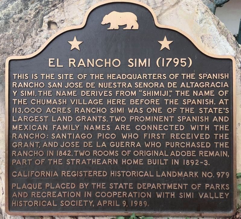
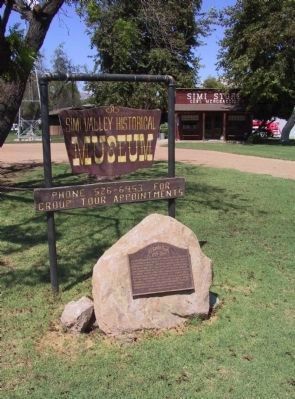
El Rancho Simi
1795
Erected 1989 by State Department of Parks and Recreation in cooperation with Simi Valley Historical Society. (Marker Number 979.)
Topics and series. This historical marker is listed in these topic lists: Hispanic Americans • Native Americans • Settlements & Settlers. In addition, it is included in the California Historical Landmarks, and the Ventura County Historical Landmarks series lists. A significant historical year for this entry is 1842.
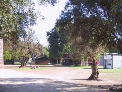
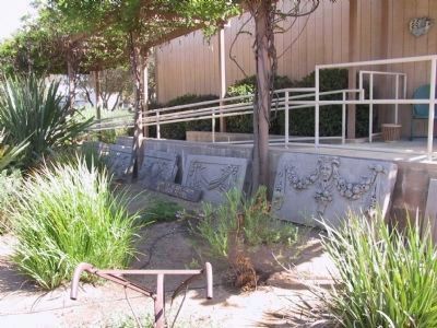
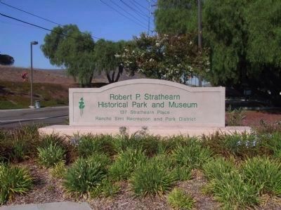
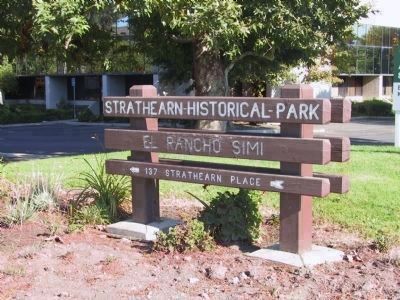
Location. 34° 16.509′ N, 118° 48.092′ W. Marker is in Simi Valley, California, in Ventura County. Marker can be reached from Strathearn Place, 0.2 miles west of Madera Road. Marker is located at the Strathearn Historical Park, open Mon-Fri 9-3, Sat-Sun 1-4. Touch for map . Marker is at or near this postal address: 137 Strathearn Place, Simi Valley CA 93063, United States of America. Touch for directions.
Other nearby markers. At least 8 other markers are within 5 miles of this marker, measured as the crow flies. Simi Adobe (a few steps from this marker); Simi Library (within shouting distance of this marker); Wood Ranch Barns (within shouting distance of this marker); F-117A Nighthawk (approx. 1˝ miles away); Ronald Wilson Reagan (approx. 1.6 miles away); Simi Elementary School (approx. 3.6 miles away); Joel McCrea Ranch (approx. 4.1 miles away); The Lang Ranch (approx. 4.4 miles away). Touch for a list and map of all markers in Simi Valley.
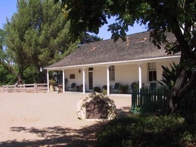
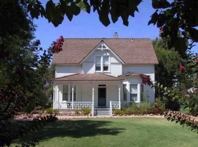
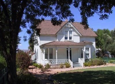
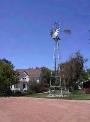
Regarding El Rancho Simi. Simi Adobe/Strathearn House (aka de la Guerra Adobe) was designated Ventura County Historical Landmark No. 6 in 1969; added to the National Register of Historic Places in 1978; and designated California Historical Landmark No. 979 in 1989.
Other Ventura County Landmarks at this location are:
Simi Library Building, built 1930, designated 1978, Landmark No. 40.
Haigh/Talley Colony House, built 1889, designated 1978, Landmark No. 41.
Chumash Village of Shimiji, 500-1800+A.D., designated 1983, Landmark No. 91.
Wood Ranch Barns, built 1945, designated 1983, Landmark No. 93.
Also see . . . Strathearn Historical Park and Museum. (Submitted on January 4, 2012, by Michael Kindig of Elk Grove, California.)
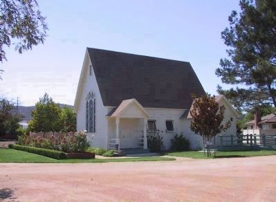
Photographed By Michael Kindig, September 1, 2007
6. Saint Rose of Lima Church
On August 10, 1902, the first house of worship in Simi Valley was dedicated as the Presbyterian Church of Simi, California. After a few years, the cost of maintaining the church became too difficult for the small group to manage, so the church was closed, with the members joining the Methodists.
In 1912, the building became a mission of the Catholic Church in Oxnard. In 1921, the church officially became the St. Rose of Lima Catholic Church with a small congregation numbering 20 families.
In 1912, the building became a mission of the Catholic Church in Oxnard. In 1921, the church officially became the St. Rose of Lima Catholic Church with a small congregation numbering 20 families.
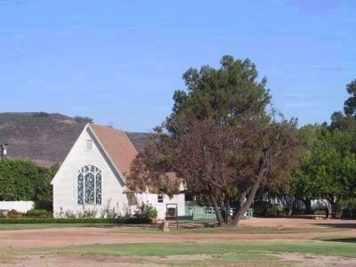
Photographed By Michael Kindig, August 18, 2007
7. Saint Rose of Lima Church
This is the oldest church building in Simi Valley. It served the local Catholic congregation beginning about 1910, when priests came over from Oxnard to conduct services. It became a parish in 1922, and was used until the congregation moved into new facilities on Royal Avenue in 1963. Towards the last of those years, it was so crowded that people were standing outside on the sidewalk with a p.a. system.
The building was moved to Strathearn Historical Park in 2002.
The building was moved to Strathearn Historical Park in 2002.
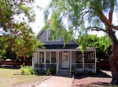
Photographed By Michael Kindig, September 1, 2007
8. Colony House
Simi Land and Water Company acquired most of El Rancho Simi, and when they began to advertise the lands for sale, they reached states in the mid-west and New England. A group of investors calling themselves the "California Mutual Benefit Colony of Chicago" bought land for a town site with nearby acreage available for farming. Their little town was called Simiopolis for a brief six-month period, but they soon went back to the simpler "Simi."
The future colonists arranged for twelve small identical houses to be pre-cut and partly assembled in Chicago, then loaded onto rail cars for their trip west.
Unfortunately, their settlement plans did not work out in this remote place, with no stores, roads or utilities of any kind, so the Colony soon folded, but their "Colony Houses" lasted well into the 20th century.
One of the Colony Houses was used for school during the week, church on Sunday, and a dance on Saturday night. Only two remain: this one, and one on its original site in the town of Simi (near Second and Pacific).
The Colony Hose was owned briefly by the Henry and Grace Haigh family. It was occupied the longest by the Mary and John Talley family and was the scene of many happy family gatherings. It was moved to the Strathearn Historical Park in 1970.
The Colony Hose was owned briefly by the Henry and Grace Haigh family. It was occupied the longest by the Mary and John Talley family and was the scene of many happy family gatherings. It was moved to the Strathearn Historical Park in 1970.
Photographed By Michael Kindig, September 1, 2007
9. Wood Ranch Open Barn
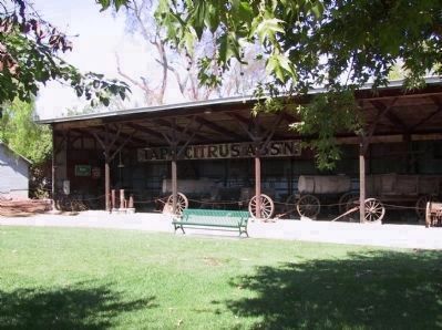
The Wood Ranch Barns. 1n 1982, when the Wood Ranch was poised to undergo development, two barns were donated to the historical park. The Simi Valley Historical Society and the Rancho Simi Recreation and Park District worked together to make the move a reality. The "Open" barn houses a collection of old wooden wagons and other farm implements. The Teaching Area in the Open Barn is also the home of the Chumash Indian displays and is used as our Chumash schoolroom during our third grade school tours. The Restoration Workshop is also housed in the Open Barn.
Photographed By Michael Kindig, September 1, 2007
16. El Rancho Simi
1795 - 1995
1795 - 1995
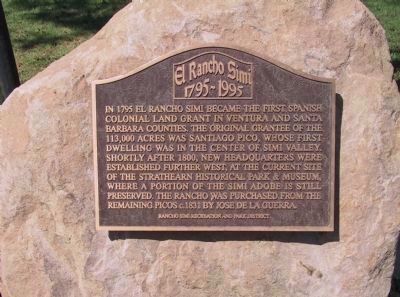
In 1795 El Rancho Simi became the first Spanish colonial land grant in Ventura and Santa Barbara counties. The original grantee of the 113,000 acres was Santiago Pico, whose first dwelling was in the center of Simi Valley. Shortly after 1800, new headquarters were established further west, at the current site of the Strathearn Historical Park & Museum where a portion of the Simi Adobe is still preserved. The rancho was purchased from the remaining Picos c. 1831 by Jose de la Guerra.
Rancho Simi Recreation and Park District
Rancho Simi Recreation and Park District
Credits. This page was last revised on June 10, 2022. It was originally submitted on December 28, 2011, by Michael Kindig of Elk Grove, California. This page has been viewed 1,587 times since then and 41 times this year. Last updated on February 25, 2021, by Craig Baker of Sylmar, California. Photos: 1. submitted on November 17, 2019, by Craig Baker of Sylmar, California. 2, 3, 4, 5, 6, 7, 8, 9, 10, 11, 12, 13, 14, 15, 16, 17, 18. submitted on January 3, 2012, by Michael Kindig of Elk Grove, California. • J. Makali Bruton was the editor who published this page.
