Near Lanfair in San Bernardino County, California — The American West (Pacific Coastal)
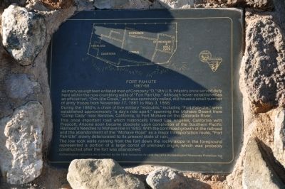
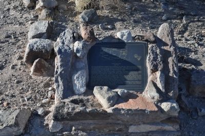
Fort Pah-Ute
1867-68
During the 1860's, a chain of five military "redoubts," including "Fort Pah-Ute," were established approximately "a day's ride apart," spanning the Mohave Desert from "Camp Cady" near Barstow, California, to Fort Mohave on the Colorado River.
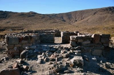
This once important road which historically linked Los Angeles, California with Prescott, Arizona soon became obsolete upon completion of the Southern Pacific Railroad's Needles to Mohave line in 1883. With the continued growth of the railroad and the abandonment of the "Mojave Road" as a major transportation route, "Fort Pah-Ute" slowly deteriorated to its present state of ruin.
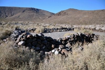
The low rock walls running from the fort down the rocky slope in the foreground represented a portion of a large corral of unknown origin, which was probably constructed after the fort was abandoned.
Archaeological resources are protected by the 1906 Antiquities Act and the 1979 Archaeological Resources Protection Act.
Topics and series. This historical marker is listed in this topic list: Forts and Castles. In addition, it is included in the Mojave Road (Old Government Road) series list. A significant historical month for this entry is May 1796.
Location. 35° 6.883′ N, 114° 59.063′ W. Marker is near Lanfair, California, in San Bernardino County. Marker can be reached from Old Government Road. Touch for map. Marker is in this post office area: Essex CA 92332, United States of America. Touch for directions.
Other nearby markers. At least 7 other markers are within 15 miles of this marker, measured as the crow flies. Ibis Divisional Camp - Desert Training Center (approx. 13.2 miles away); Mining Town of Hart (approx. 13.8 miles away); Goffs Schoolhouse (approx. 14.2 miles away); a different marker also named Goffs Schoolhouse (approx. 14.2 miles away); Cal-Nev-Ari (approx. 14.2 miles away in Nevada); Army Camp at Goffs (approx. 14.2 miles away); Pah-Ute Creek (approx. 14.2 miles away).
More about this marker. The marker is located out in the open desert in the Mojave National Preserve accessible by 4-wheel drive vehicles.
The address of the reserve is:
Mojave Desert Outpost 49448 Ivanpah Road, Lanfair Valley, San Bernardino Co., California.
Credits. This page was last revised on February 29, 2024. It was originally submitted on January 2, 2012, by Michael Kindig of Elk Grove, California. This page has been viewed 785 times since then and 26 times this year. Photos: 1, 2, 3, 4. submitted on January 2, 2012, by Michael Kindig of Elk Grove, California. • Syd Whittle was the editor who published this page.


