Near Mount Jewett in McKean County, Pennsylvania — The American Northeast (Mid-Atlantic)
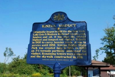
Kinzua Viaduct
Inscription.
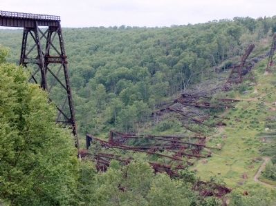
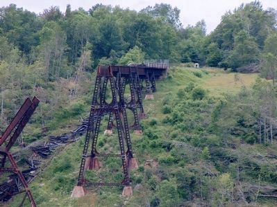
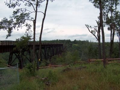
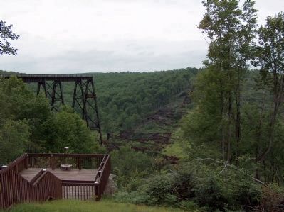
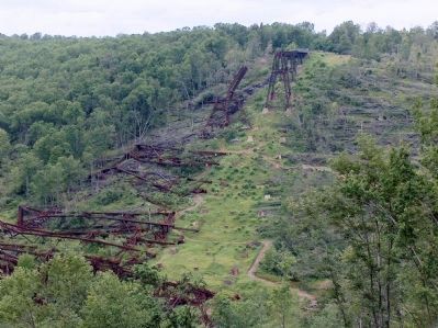
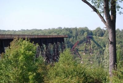
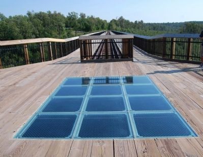
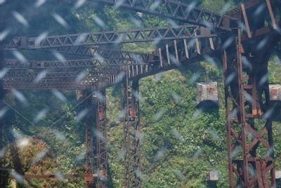
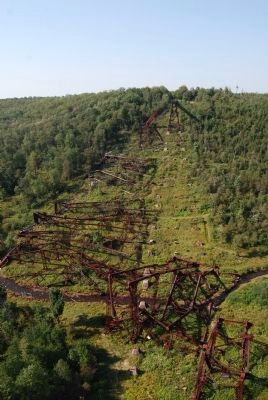
Originally begun in 1881 for the New York, Lake Erie & Western Railroad to ship coal, lumber, and oil, it was once the world’s highest and longest rail viaduct. Rebuilt in 1900 to carry heavier loads, it was in service until 1959. Kinzua Bridge State Park was created here in 1963. In 2003 an F-1 tornado partially destroyed the viaduct. Remaining towers were restored and the skywalk constructed in 2011.
Erected 2011 by Pennsylvania Historical and Museum Commission.
Topics and series. This historical marker is listed in these topic lists: Bridges & Viaducts • Disasters • Railroads & Streetcars. In addition, it is included in the ASCE Civil Engineering Landmarks, and the Pennsylvania Historical and Museum Commission series lists. A significant historical year for this entry is 1881.
Location. 41° 45.56′ N, 78° 35.215′ W. Marker is near Mount Jewett, Pennsylvania, in McKean County. Marker can be reached from Pennsylvania Route 3011, half a mile east of U.S. 6. East on Lindholm road about one-half mile off US Highway 6. Just east of Mount Jewett. Touch for map. Marker is in this post office area: Mount Jewett PA 16740, United States of America. Touch for directions.
Other nearby markers. At least 8 other markers are within 8 miles of this marker, measured as the crow flies. Spanning History (within shouting distance of this marker); Sites to See (within shouting distance of this marker); Kinzua Bridge (about 300 feet away, measured in a direct line); Commerce to Collapse (about 300 feet away); Forces of Nature (about 400 feet away); Nebo Lutheran Chapel and Cemetery (approx. 4.4 miles away); Great Events in Smethport History (approx. 7.9 miles away); a different marker also named Great Events in Smethport History (approx. 7.9 miles away). Touch for a list and map of all markers in Mount Jewett.
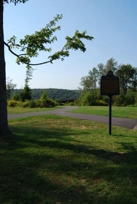
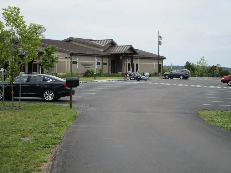
More about this marker. Marker located inside Kinzua Bridge State Park.
Regarding Kinzua Viaduct. Kinzua Bridge spanning Kinzua Creek, original bridge built in 1882, subsequent bridge built in 1900 and destroyed in 2003 by a tornado. At the time it was built, the original (c. 1882) Kinzua Bridge was the highest, at 301 feet (92 m), and longest, at 2,053 feet (626 m), railway bridge in the world, given the distinction of being listed as a Historic Civil Engineering Landmark (the listing was in 1977). The Erie Railroad company originally owned and operated the bridge.
Also see . . .
Photographed By Cosmos Mariner, June 25, 2004
2. Previous Kinzua Viaduct Marker
Previous inscription
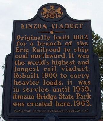
Originally built 1882 for a branch of the Erie Railroad to ship coal northward. It was the world's highest and longest rail viaduct. Rebuilt 1900 to carry heavier loads, it was in service until 1959. Kinzua Bridge State Park was created here, 1963.
Originally built 1882 for a branch of the Erie Railroad to ship coal northward. It was the world's highest and longest rail viaduct. Rebuilt 1900 to carry heavier loads, it was in service until 1959. Kinzua Bridge State Park was created here, 1963.
1. Kinzua Viaduct - Behind the Marker. Explorepahistory.com (Submitted on September 4, 2012, by Mike Wintermantel of Pittsburgh, Pennsylvania.)
2. MarkerQuest - Kinzua Viaduct. More information about the history of Kinzua Viaduct and Kinzua Bridge State Park. (Submitted on July 1, 2020, by Laura Klotz of Northampton, Pennsylvania.)
Additional keywords. tornado
Credits. This page was last revised on July 1, 2020. It was originally submitted on January 5, 2012, by Cosmos Mariner of Cape Canaveral, Florida. This page has been viewed 1,043 times since then and 25 times this year. Photos: 1. submitted on September 3, 2012, by Mike Wintermantel of Pittsburgh, Pennsylvania. 2, 3. submitted on January 5, 2012, by Cosmos Mariner of Cape Canaveral, Florida. 4. submitted on September 3, 2012, by Mike Wintermantel of Pittsburgh, Pennsylvania. 5. submitted on July 2, 2017, by Anton Schwarzmueller of Wilson, New York. 6, 7, 8, 9, 10, 11. submitted on January 5, 2012, by Cosmos Mariner of Cape Canaveral, Florida. 12, 13, 14, 15. submitted on September 3, 2012, by Mike Wintermantel of Pittsburgh, Pennsylvania. • Bill Pfingsten was the editor who published this page.
