Merriam in Johnson County, Kansas — The American Midwest (Upper Plains)
Campbell Home
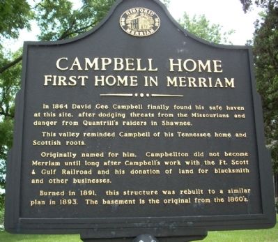
First Home In Merriam
This valley reminded Campbell of his Tennessee home and his Scottish roots.
Originally named for him, Campbelltown did not become Merriam until long after Campbell's work with the Ft Scott & Gulf Railroad and his donation of land for blacksmith and other businesses.
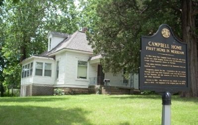
Burned in 1891, this structure was rebuilt to a similar plan in 1893. The basement is the original from the 1860's.
Topics. This historical marker is listed in these topic lists: Industry & Commerce • Notable Buildings • Settlements & Settlers. A significant historical year for this entry is 1864.
Location. 39° 1.347′ N, 94° 41.73′ W. Marker is in Merriam, Kansas, in Johnson County. Marker is on Johnson County, 0.1 miles west of Campbell Street, on the left. Touch for map. Marker is at or near this postal address: 9503 Johnson Drive, Shawnee KS 66203, United States of America. Touch for directions.
Other nearby markers. At least 8 other markers are within walking distance of this marker. Merriam Community Center (approx. ¼ mile away); Shawnee Friends Mission (approx. 0.6 miles away); a different marker also named Shawnee Friends Mission (approx. 0.6 miles away); The Overland Trails (approx. 0.6 miles away); The People of the South Wind & the Coming of the Shawnee (approx. 0.6 miles away); The Founding of Campbellton (approx. 0.6 miles away); Merriam Park & George Kessler (approx. 0.6 miles away); The Trolley Line & Hocker Grove Amusement Park (approx. 0.6 miles away). Touch for a list and map of all markers in Merriam.
More about this marker. Johnson Drive is a major four-lane street with no parking. Park in the church parking lot and walk to the marker.
Also see . . . City of Merriam Visitor's Bureau. This official link to the City of Merriam has further links to all of the historical markers throughout the city. (Submitted on July 7, 2009, by Thomas Onions of Olathe, Kansas.)

Photographed By Thomas Onions, December 23, 2008
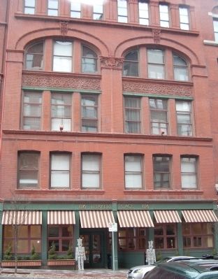
3. KC, Ft Scott & Gulf Railroad Building
This is the former headquarters of the Kansas City, Fort Scott, & Gulf Railroad. It is located at 9th & Broadway in Kansas City, Mo. This building, listed on the National Register of Historic Places as a Contributing Building, is now used as office space by DST Systems.
Credits. This page was last revised on January 15, 2021. It was originally submitted on July 7, 2009, by Thomas Onions of Olathe, Kansas. This page has been viewed 1,617 times since then and 77 times this year. Last updated on January 5, 2012, by James Grooms of Shawnee, Kansas. Photos: 1, 2, 3. submitted on July 7, 2009, by Thomas Onions of Olathe, Kansas. • Bill Pfingsten was the editor who published this page.

