San Diego in San Diego County, California — The American West (Pacific Coastal)
Boundary Marker Number 258
Inscription.
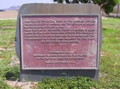
Near this site the initial point of the boundary between the United States of America and the Republic of Mexico was established October 10, 1849.
Today, the flag of the United States of America is again raised to symbolize friendship between the peoples of the United States and Mexico and to commemorate the establishment of a State Park adjacent to this point on the International Border.
Boundary Marker Number 258 was placed
on the National Register of Historic
Places September 6, 1974
Erected 1974.
Topics. This historical marker is listed in this topic list: Notable Places. A significant historical date for this entry is October 10, 1849.
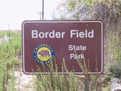
Location. 32° 32.073′ N, 117° 7.367′ W. Marker is in San Diego, California, in San Diego County. Marker can be reached from Monument Road. The marker is located at Border Field State Park. Touch for map. Marker is in this post office area: San Diego CA 92154, United States of America. Touch for directions.
Other nearby markers. At least 8 other markers are within 11 miles of this marker, measured as the crow flies. Montgomery Memorial (approx. 4.4 miles away); National City Depot (approx. 8.7 miles away); National City Historic Railcar Plaza (approx. 8.7 miles away); United We Land (approx. 9.8 miles away); The Naked Warrior (approx. 10.1 miles away); "Imagine Tent City" (approx. 10.4 miles away); Dragon Tree (approx. 10.6 miles away); Carlin House - 1939 (approx. 10.6 miles away).
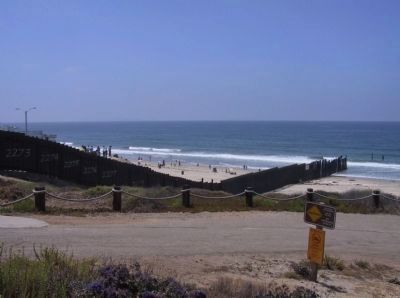
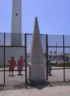
Also see . . . Border Field State Park. At the very southwest corner of America is a monument marking the border between Mexico and California. When California became a territory at the end of the Mexican-American War, an international border became a necessity. American and Mexican survey crews determined the boundary and the monument of Italian marble was placed in 1851 to mark the original survey site. Today the monument stands in the shadow of the Tijuana Bull Ring and still delineates the border between the United States and Estádos Unídos Mexicanos. (Submitted on January 23, 2012.)
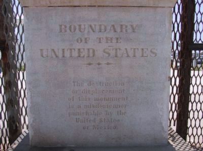
Photographed By Michael Kindig, Boundary o
3. Boundary Marker Number 258 (1894)
NORTH FACE “Boundary of the United States. The destruction or displacement of this monument is a misdemeanor punishable in the United States or Mexico.”
WEST FACE “Initial point of Boundary between the United States and Mexico. Established by a joint commission on October A.D. 1848 agreeable to the Treaty dated at the City of Guadalupe-Hildago February 2 A.D. 1851. John B Weller U.S. Commissioner, Andrew B. Gray, U.S. Surveyor.”
EAST FACE “Reconstructed August 1894 by the International Boundary Commission operated by the conventions of 1882 and 1889.”
Credits. This page was last revised on June 16, 2016. It was originally submitted on January 13, 2012, by Michael Kindig of Elk Grove, California. This page has been viewed 999 times since then and 27 times this year. Photos: 1, 2, 3, 4, 5, 6. submitted on January 13, 2012, by Michael Kindig of Elk Grove, California. • Syd Whittle was the editor who published this page.
