Brunswick in Cumberland County, Maine — The American Northeast (New England)
Site of Fort Andross and Fort George
Inscription.
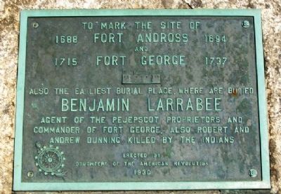
1688 Fort Andross 1694
and
1715 Fort George 1737
Also the earliest burial place
where are buried
Benjamin Larrabee
Agent of the Pejepscot Proprietors and
Commander of Fort George. Also
Robert and Andrew Dunning,
killed by the Indians
Erected 1930 by Daughters of the American Revolution.
Topics and series. This historical marker is listed in these topic lists: Colonial Era • Forts and Castles • Wars, US Indian. In addition, it is included in the Daughters of the American Revolution series list. A significant historical year for this entry is 1688.
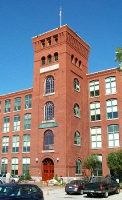
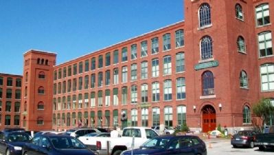
Location. 43° 55.143′ N, 69° 58.023′ W. Marker is in Brunswick, Maine, in Cumberland County. Marker is near the entrance to the Fort Andross Mill Business Center (former textile mill). Touch for map. Marker is at or near this postal address: 14 Maine Street (Maine Route 24), Brunswick ME 04011, United States of America. Touch for directions.
Other nearby markers. At least 8 other markers are within walking distance of this marker. Androscoggin Swinging Bridge (approx. 0.3 miles away); Founding of the Maine Medical Association (approx. 0.3 miles away); Brunswick Veterans Memorial (approx. 0.4 miles away); Harriet Beecher Stowe House (approx. half a mile away); Company K, 1st Maine Volunteer Infantry (approx. 0.6 miles away); Home of Joshua Lawrence Chamberlain (approx. 0.6 miles away); Robinson Memorial Gate (approx. 0.6 miles away); Bowdoin College World War Memorial (approx. 0.8 miles away). Touch for a list and map of all markers in Brunswick.
Also see . . . Maine History Online: Settlement & Strife, 1668-1774. (Submitted on January 24, 2012, by William Fischer, Jr. of Scranton, Pennsylvania.)
Credits. This page was last revised on October 29, 2020. It was originally submitted on January 23, 2012, by William Fischer, Jr. of Scranton, Pennsylvania. This page has been viewed 1,312 times since then and 45 times this year. Photos: 1, 2, 3. submitted on January 24, 2012, by William Fischer, Jr. of Scranton, Pennsylvania.


