Dumfries in Prince William County, Virginia — The American South (Mid-Atlantic)
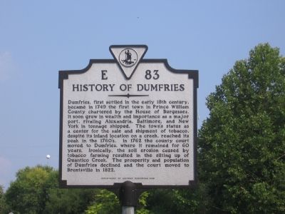
History of Dumfries
Dumfries, first settled in the early 18th century, became in 1749 the first town in Prince William County chartered by the House of Burgesses. It soon grew in wealth and importance as a major port, rivaling Alexandria, Baltimore, and New York in tonnage shipped. The town's status as a center for the sale and shipment of tobacco despite its inland location on a creek, reached its peak in the 1760's. In 1762 the county court moved to Dumfries, where it remained for 60 years. Ironically, the soil erosion caused by tobacco farming resulted in the silting up of Quantico Creek. The prosperity and population of Dumfries declined and the court moved to Brentsville in 1822.
Erected 1993 by Department of Historic Resources. (Marker Number E-83.)
Topics and series. This historical marker is listed in these topic lists: Colonial Era • Industry & Commerce • Settlements & Settlers • Waterways & Vessels. In addition, it is included in the Virginia Department of Historic Resources (DHR) series list. A significant historical year for this entry is 1749.
Location. 38° 33.983′ N, 77° 19.464′ W. Marker is in Dumfries, Virginia, in Prince William County. Marker is on Frayley Boulevard (U.S. 1) north of Williamstown Drive, on the right when traveling north. It is next to Cecil Garrison Park. Touch for map. Marker is in this post office area: Dumfries VA 22026, United States of America. Touch for directions.
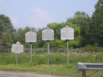
Other nearby markers. At least 5 other markers are within walking distance of this marker. Dumfries Raid (a few steps from this marker); Revolutionary War Campaign of 1781 (a few steps from this marker); Graham Park (a few steps from this marker); Dumfries - Love’s Tavern (approx. 0.2 miles away); Colonial Dumfries - Williams Ordinary (approx. 0.2 miles away). Touch for a list and map of all markers in Dumfries.
Also see . . . Dumfries, Virginia. Wikipedia entry (Submitted on September 13, 2006.)
Credits. This page was last revised on February 26, 2024. It was originally submitted on September 10, 2006, by Jeremy Prats of Afton, Virginia. This page has been viewed 2,465 times since then and 57 times this year. Photos: 1, 2. submitted on September 10, 2006, by Jeremy Prats of Afton, Virginia. • J. J. Prats was the editor who published this page.

