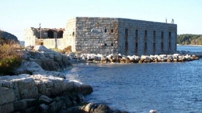
Near Phippsburg in Sagadahoc County, Maine — The American Northeast (New England)
Forts on the Kennebec River
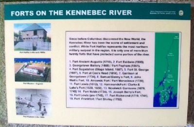
Since before Columbus discovered the New World, the Kennebec River has been the scene of settlement and conflict. While Fort Halifax represents the most northern military outpost in the region, it is only one of more than twenty forts that have protected some portion of the river.
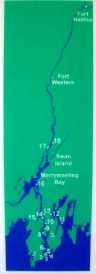
1. Fort Ancient Augusta (1718), 2. Fort Baldwin (1905), 3. Georgetown Battery (1808)/Fort Popham (1861), 4. Fort Sagadahoc (Stage Island, 1607), 5. Fort St. George (1607), 6. Fort at Cox's Head (1814), 7. Garrison at Georgetown (1734), 8. Samuel Denny's Fort [no date], 9. John Watt's Fort [no date], 10. Arrowsic Fort/Fort Menaskoux (1720), 11. Fort Lewis (1812), 12. Hammond's Fort/Clarke & Lake's Fort (1630, 1658), 13. Woolwich Garrisons (1676, 1740), 14. Fort Noble (1734), 15. Joseph Berry's Fort [no date], 16. Fort Lewis (pre-1745), 17. Fort Richmond (1719, 1741), 18. Fort Frankfort/Fort Shirley (1752).
Erected by Maine Department of Conservation.
Topics. This historical marker is listed in these topic lists: Forts and Castles • War, US Civil • Waterways & Vessels.
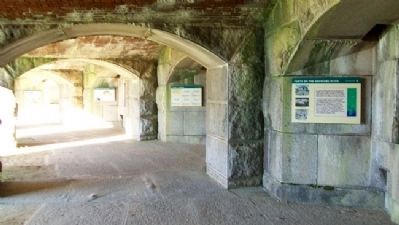
Location. 43° 45.299′ N, 69° 47′ W. Marker is near Phippsburg, Maine, in Sagadahoc County. Marker is on a lower casement (gun deck) wall inside Fort Popham State Historic Site, off Popham Road (Maine Route 209). Touch for map. Marker is in this post office area: Phippsburg ME 04562, United States of America. Touch for directions.
Other nearby markers. At least 8 other markers are within 10 miles of this marker, measured as the crow flies. Firing a Cannon (here, next to this marker); The Casemate Key to a Fort's Design (a few steps from this marker); Fort Popham: Guardian of the Kennebec (a few steps from this marker); Percival P. Baxter (a few steps from this marker); Sites of Forts in this Area (within shouting distance of this marker); Fort Popham State Historic Site (about 600 feet away, measured in a direct line); Phippsburg Veterans and Mariners Memorial (approx. 4.2 miles away); The Caulkers' Shed (1899) (approx. 9.8 miles away). Touch for a list and map of all markers in Phippsburg.
Also see . . .
1. Fort Popham State Historic Site. (Submitted on February 3, 2012, by William Fischer, Jr. of Scranton, Pennsylvania.)
2. Fort Popham, Maine. (Submitted on February 3, 2012, by William Fischer, Jr. of Scranton, Pennsylvania.)
3. Forts of Mid-Coast Maine. (Submitted on February 3, 2012, by William Fischer, Jr. of Scranton, Pennsylvania.)
Credits. This page was last revised on September 23, 2020. It was originally submitted on February 3, 2012, by William Fischer, Jr. of Scranton, Pennsylvania. This page has been viewed 1,151 times since then and 41 times this year. Photos: 1, 2, 3, 4. submitted on February 3, 2012, by William Fischer, Jr. of Scranton, Pennsylvania. 5. submitted on January 31, 2012, by William Fischer, Jr. of Scranton, Pennsylvania.
