Niagara-on-the-Lake in Niagara Region, Ontario — Central Canada (North America)
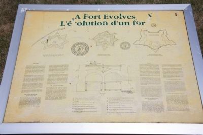
A Fort Evolves
Fort Mississauga
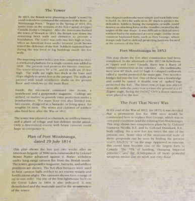
By 1813, the British were planning to build "a tower in small redoubt to command the entrance of the River...at Mississauga Point." Begun in the Spring of 1814, this tower rests on the remains of the first Capital of Upper Canada (today's Ontario). After the Americans burned the town of Newark in 1813, the British tore down the remaining brick walls and chimneys to provide a foundation. The tower was only two feet high in July when an American force under General Jacob Brown tested the defenses of the fort. Soldiers stationed here during the war lived in log buildings inside the fort walls.
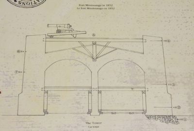
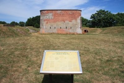
The imposing tower before you was completed in 1823. A reinforced platform for a single cannon was added in 1838. The present roof protects the historic structure. The tower measures 50' x 50', and its walls are 25 feet high. The walls are eight feet thick at the base and slope slightly to seven feet at the parapet. The walls are pierced with small ventilation shafts on the ground floor and windows on the main floor.
Inside, the basement contained two rooms, a storehouse and a gunpowder magazine. Ceilings are arched, or vaulted to provide extra protection under a bombardment. The main floor was also divided into two rooms, designed as a barracks, or living space for roughly 34 men. The wives and children of soldiers also lived here after the War of 1812.
The tower was planned as a barrack, an artillery battery, and a place of refuge and last defense under attack. Only a determined enemy with heavy cannons could hope to overpower it
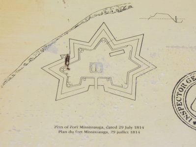
dated 29 July 1814
This plan shows the fort just two weeks after an American brigade of 3,000 men commanded by Colonel Moses Porter advanced against it. Porter withdrew under long range cannon fire from the British inside. The tower, gunpowder magazine, barracks, and artillery positions are shown. The hot shot furnaces were used to heat cannon balls red-hot to set enemy vessels and fortifications alight. The cannons shown have a range of up to one mile! The site of the first lighthouse built on the Great Lakes in 1804 is also indicated. It was demolished and the materials used in the construction of the tower.
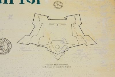
Star-shaped earthworks were simple and took little time to build. In 1814 the walls were 20' thick to protect the defenders. Soldiers lining the ramparts, or walls, could destroy an attacking force in the crossfire created by the angles of the star shape. It was difficult to defend since soldiers had to be stationed at every angle, unlike more common bastioned forts, such as Fort George, where troops only had to
defend projecting bastions located at the corners of the fort.
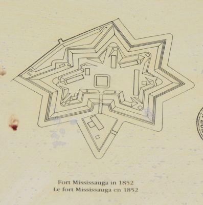
This map shows the fort after construction had been completed. In the aftermath of the 1837-38 Rebellions in Upper and Lower Canada, there was a flurry of military construction in the colonies...the earthworks were now 40' thick, and 12' high. A v-shaped earthwork called a ravelin protected the main gate. Two wooden bridges led into the fort. One of these was a drawbridge and could be raised. A double row of spiked logs protected the fort. The inner row of logs was placed vertically, with the outer row set into the ground at a 45 degree angle, facing the enemy. Over a dozen cannons were placed in the fort.
At the end of the War of 1812, (in 1815) it was decided that a permanent fort for 1,000 men would be constructed here to replace Fort George, which was in very poor condition (and the existing Fort Mississauga). This map shows two comparison plans by Lt. Colonel Gustavus Nicolls, R.E. and Lt. Colonel Durnford, R.E., both calling for a new fort ten times the size of the present one. Some idea of the monumental scale of these proposals can be seen by finding the present tower, labelled "A" on the map. Approved in concept, this could have become one of the largest
forts in Canada. The lack of funding, changing Imperial priorities and the development of more powerful weapons meant that no work was ever done.
Topics. This historical marker is listed in these topic lists: Colonial Era • Forts and Castles • War of 1812. A significant historical year for this entry is 1813.
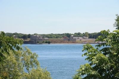
Location. 43° 15.687′ N, 79° 4.596′ W. Marker is in Niagara-on-the-Lake, Ontario, in Niagara Region. Marker can be reached from Simcoe Street just north of Front Street. This historical marker is located on the Canadian side of the mouth of the Niagara River, where the river empties into Lake Ontario. It is situated along the river on the northern edge of the Niagara-on-the-Lake Golf Course, inside of the earthworks surrounding Fort Mississauga, just to the south of the brick fortification that is situated in the center of Fort Mississauga. Touch for map. Marker is in this post office area: Niagara-on-the-Lake ON L0S 1J0, Canada. Touch for directions.
Other nearby markers. At least 8 other markers are within walking distance of this marker. A Strategic Location (a few steps from this marker); Fort Mississauga (within shouting distance of this marker); Point Mississauga Lighthouse (within shouting distance of this marker); Fort Mississauga is a National Historic Site (within shouting distance of this marker); Fort Mississauga Trail (about 180 meters away, measured
in a direct line); The Remains of Three Soldiers (approx. 0.7 kilometers away); The Battle of Fort George (approx. 0.7 kilometers away); Niagara on the Lake Historical District (approx. 0.8 kilometers away). Touch for a list and map of all markers in Niagara-on-the-Lake.
Credits. This page was last revised on September 27, 2019. It was originally submitted on February 3, 2012, by Dale K. Benington of Toledo, Ohio. This page has been viewed 603 times since then and 5 times this year. Photos: 1, 2, 3, 4, 5, 6, 7, 8, 9. submitted on February 4, 2012, by Dale K. Benington of Toledo, Ohio.
