Sharpsburg in Washington County, Maryland — The American Northeast (Mid-Atlantic)
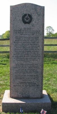
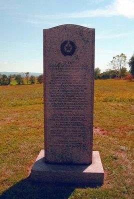
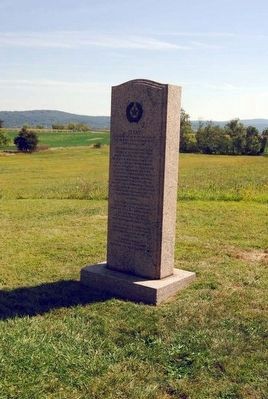
Texas
her sons who served at Sharpsburg
September 16-17, 1862
Here in the Cornfield, early on the
morning of September 17 the Texas
Brigade helped blunt the attack of
elements of Mansfield's Union Corps
almost alone during this powerful
Federal onslaught the Texas Brigade
sealed a threatening gap in the
Confederate line in so doing the 1st
Texas Infantry Regiments suffered a
casualty rate of 82.3 per cent, the
greatest loss suffered by any infantry
regiment, North or South, during the war
Of approximately 850 men engaged the
Texas Brigade counted over 530
casualties.
Texas troops at Sharpsburg were
1st Texas Inf, Lt. Col. P.A. Work; 4th
Texas Inf, Lt. Col. B.F. Carter; 5th Texas
Inf., Capt. Ike N.M. Turner. (Col. W.T. Wofford's Texas
Brigade, Hood's Division, Longstreet's Corps)
The Texas Brigade included the 18th
Georgia Inf, Lt. Col. S. Z. Ruff, Hampton
South Carolina Legion (Inf. Cos.) Lt
Col. M.W. Cary
A memorial to Texans
Who served the Confederacy
Erected by the State of Texas 1964
Erected 1964 by State of Texas.
Topics. This historical marker is listed in this topic list: War, US Civil. A significant historical month for this entry is September 1913.
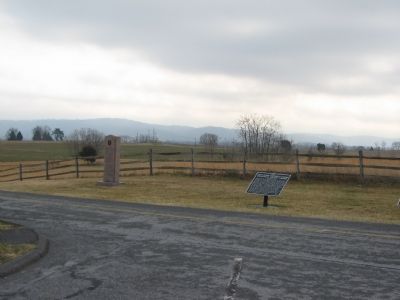
Location. 39° 28.85′ N, 77° 44.818′ W. Marker is in Sharpsburg, Maryland, in Washington County. Marker is at the intersection of Cornfield Avenue and Dunker Church Road, on the right when traveling east on Cornfield Avenue. Located near stop four of the driving tour of Antietam Battlefield and stop six of the Cornfield walking trail. Touch for map. Marker is in this post office area: Sharpsburg MD 21782, United States of America. Touch for directions.
Other nearby markers. At least 8 other markers are within walking distance of this marker. Hood's Division, Longstreet's Command (here, next to this marker); First Army Corps (a few steps from this marker); 84th New York (14th Brooklyn) Volunteer Infantry (a few steps from this marker); a different marker also named Hood's Division, Longstreet's Command (a few steps from this marker); Longstreet's Command (within shouting distance of this marker); Jackson's Command (within shouting distance of this marker); "Every Stalk of Corn" (within shouting distance of this marker); A Cornfield Unlike Any Other (within shouting distance of this marker). Touch for a list and map of all markers in Sharpsburg.
Related markers. Click here for a list of markers that are related to this marker. One of a set of Texas Civil War Memorials
Also see . . .
1. Hood's Texas Brigade. Handbook of Texas Online website entry (Submitted on February 8, 2008, by Craig Swain of Leesburg, Virginia.)
2. Hood's Brigade. "Antietam on the Web" summary of the brigade. Links to subordinate unit action summaries and maps. The brigade was known also by the name of its previous commander, Gen. John B. Hood. (Submitted on February 8, 2008, by Craig Swain of Leesburg, Virginia.)
3. Texas Monument. National Park Service site detailing the monument. (Submitted on February 8, 2008, by Craig Swain of Leesburg, Virginia.)
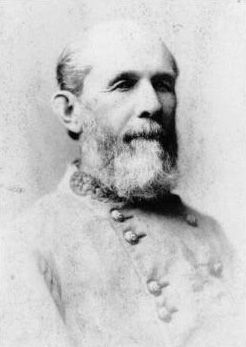
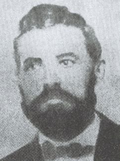
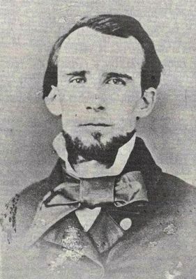
4. William T. Wofford. William Tatum Wofford (June 28, 1824 – May 22, 1884) was an officer during the Mexican-American War and a general in the Confederate States Army during the American Civil War. (Submitted on October 20, 2015, by Brian Scott of Anderson, South Carolina.)
Additional commentary.
1. Texas Civil War Monuments
This marker is one of 19 monuments placed by the State of Texas on battlefields across the nation, preserving the memories of the contributions made by the state’s military units during the Civil War.
In 1961 the Texas Civil War Centennial Commission and the Texas State Historical Survey Committee initiated this commemorative series of granite monuments by dedicating the first and largest of the original Centennial monuments at Vicksburg National Military Park, Mississippi. Over the next three years monuments were also placed in the towns of Pea Ridge, Arkansas and Anthony, Texas (for the Arizona-New Mexico campaign) and at the following battlefields: Chickamauga, Georgia; Kennesaw Mountain, Georgia; Mansfield, Louisiana; Antietam, Maryland; Bentonville, North Carolina; Gettysburg, Pennsylvania; Fort Donelson, Tennessee; Shiloh, Tennessee; and The Wilderness, Virginia.
Starting in 1998, the Texas Historical Commission continued the work begun in 1961 by the Centennial Commission and the Historical Survey Committee by placing granite monuments at other Civil War battlefields. As of 2017, monuments have been placed at the battlefields of Galveston, Texas (1998); Raymond, Mississippi (2002); Rowlett’s Station, Kentucky (2008); Richmond, Kentucky (2009); Corinth, Mississippi (2010); Gaines Mill, Virginia(2012); and Second Manassas, Virginia (2012).
The Texas Historical Commission plans to place a monument at the battlefield of Glorieta Pass, New Mexico.
(Source: Texas Historical Commission, 2015)
NOTE: The links above will take you the HMdb record for the Texas Monument of that battle or campaign.
— Submitted July 17, 2016, by Duane Hall of Abilene, Texas.
Photographed By Craig Swain, September 17, 2007
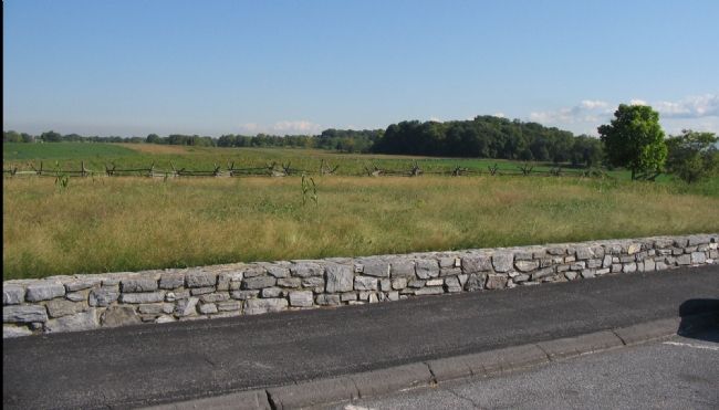
11. The Cornfield
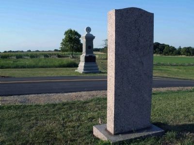
The Texas Brigade drove their way north into the Cornfield across what is today the tour road pull off. At the beginning of the battle, the ground beyond the snake rail fence was high corn. After the battle the corn had been trampled, turn by bullets, and shredded by artillery. Here veterans described seeing bodies laying in such concentration they could walk from corner to corner without touching the ground.
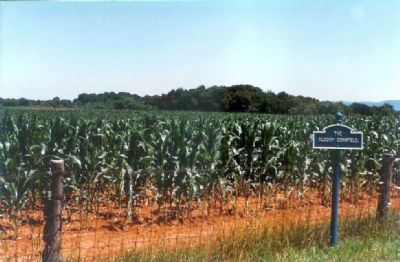
Photographed By Mike Stroud, circa 1998
12. The Bloody Cornfield as it Looked in the 1990s
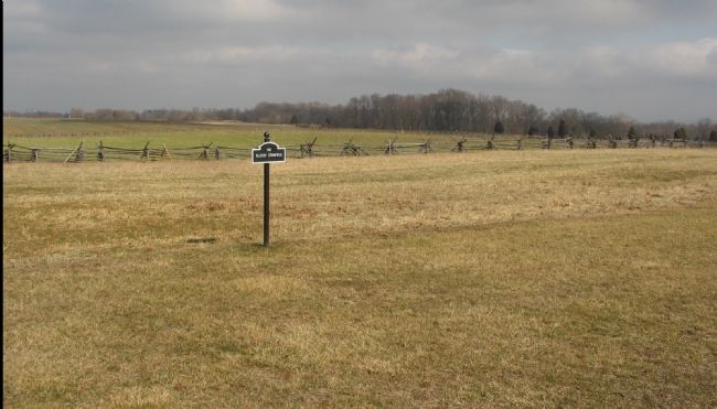
Compare to the more recent photo. The park service has taken on the task of restoring the battlefield as closely as possible to the wartime appearance. In the case of the cornfield, gone is the wire fence seen in the foreground here.
Photographed By Craig Swain, February 9, 2008
13. View of the Cornfield Today
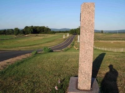
The metal fence is gone, replaced by a snake rail fence. And the fence line was moved back further from the road. The historical cornfield extended east from the Hagerstown Pike but at an angle slightly to the north. Thus it should not be exactly parallel to the non-historical Cornfield Avenue. The grass now between the road and the cornfield more accurately depicts the border of the field and gives a better feel for the terrain for the visitor today.
Credits. This page was last revised on April 2, 2022. It was originally submitted on February 8, 2008, by Craig Swain of Leesburg, Virginia. This page has been viewed 1,731 times since then and 35 times this year. Photos: 1. submitted on February 8, 2008, by Craig Swain of Leesburg, Virginia. 2, 3. submitted on January 2, 2012, by Eric Milask of Cherry Hill, New Jersey. 4. submitted on October 20, 2015, by Brian Scott of Anderson, South Carolina. 5. submitted on February 9, 2008, by Craig Swain of Leesburg, Virginia. 6, 7, 8, 9, 10. submitted on October 20, 2015, by Brian Scott of Anderson, South Carolina. 11. submitted on February 8, 2008, by Craig Swain of Leesburg, Virginia. 12. submitted on February 9, 2008, by Mike Stroud of Bluffton, South Carolina. 13. submitted on February 9, 2008, by Craig Swain of Leesburg, Virginia.
