Fort Smith in Sebastian County, Arkansas — The American South (West South Central)
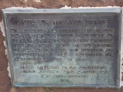
Battle of Massard Prairie
Erected 1976 by United Daughters of the Confederacy, Varina Jefferson Chapter 252, Fort Smith, Arkansas.
Topics and series. This historical marker is listed in these topic lists: Native Americans • War, US Civil. In addition, it is included in the United Daughters of the Confederacy series list. A significant historical date for this entry is July 27, 1864.
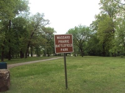
Location. 35° 18.683′ N, 94° 22.876′ W. Marker is in Fort Smith, Arkansas, in Sebastian County. Marker is on Morgans Way, 0.1 miles west of Red Pine Drive. To reach Massard Prairie Battlefield Park travel south on Red Pine Drive from Geren Road. At the end of Red Pine Drive turn right on Morgans Way. The battlefield park is directly ahead. Touch for map. Marker is in this post office area: Fort Smith AR 72908, United States of America. Touch for directions.
Other nearby markers. At least 8 other markers are within 6 miles of this marker, measured as the crow flies. Immaculate Conception Church in 1906 (approx. 5.4 miles away); The New Theatre in 1911 (approx. 5˝ miles away); Texas Corner in 1958 (approx. 5˝ miles away); Fort Towson Trail (approx. 5.6 miles away); Great Cyclone at Fort Smith (approx. 5.6 miles away); The Reserve (approx. 5.6 miles away); Veterans Memorial Carillon (approx. 5.7 miles away); William O. Darby (approx. 5.7 miles away). Touch for a list and map of all markers in Fort Smith.
Credits. This page was last revised on June 16, 2016. It was originally submitted on February 12, 2012, by Michael Manning of Woodlawn, Tennessee. This page has been viewed 1,279 times since then and 45 times this year. Photos: 1, 2, 3. submitted on February 12, 2012, by Michael Manning of Woodlawn, Tennessee. • Craig Swain was the editor who published this page.


