Bear Mountain in Rockland County, New York — The American Northeast (Mid-Atlantic)
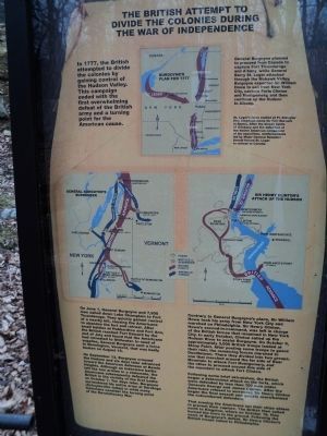
The British Attempt to Divide the Colonies during the War of Independence
Inscription.
In 1777, the British attempted to divide the colonies by gaining control of the Hudson Valley. This campaign ended with the first overwhelming defeat of the British army and a turning point for the American cause.
General Burgoyne planned to proceed from Canada to capture Fort Ticonderoga and Albany, while General Barry St. Leger attacked through the Mohawk Valley. Burgoyne expected Sir William Howe to sail from New York City, capture Forts Clinton and Montgomery, and then continue up the Hudson to Albany.
St. Leger’s force stalled at Ft. Schuyler (the American name for Fort Stanwix in Rome). After the bloody battle of Oriskany and the defection of the Native American component of his expedition, reinforcements led by Major General Benedict Arnold forced St. Leger to retreat to Canada.
On June 1, General Burgoyne and 7,900 men sailed down Lake Champlain to Fort Ticonderoga. They quickly gained control of a nearby hill, causing the Americans to abandon the fort and retreat. After small battles at Hubbardton and Fort Ann, the British reached Fort Edward by the end of July and found that the Americans had retreated to Stillwater. In need of supplies, General Burgoyne sent a force to Bennington, Vermont, that was badly beaten on August 16.
On September 13, Burgoyne crossed the Hudson and six days later advanced towards the American defenses at Bemis Heights. Although an indecisive battle left the two armies in a stalemate, the Americans subsequently defeated the British in the vicinity of the first battle on October 7. Ten days later, Burgoyne surrendered his entire army at Saratoga (Schuylerville today) in what many historians consider the turning point of the Revolutionary War.
Contrary to General Burgoyne’s plans, Sir William Howe took his army from New York City and marched to Philadelphia. Sir Henry Clinton, Howe’s second-in-command, was left in charge of the British forces that remained in New York City. In early October, Clinton sailed up the Hudson River to assist Burgoyne. On October 6, approximately 3,000 British troops landed at Stony Point. After posting some troops to guard their rear, the remaining forces marched to Doodletown. There they divided into two groups, one that marched around the far side of Bear Mountain to attack Fort Montgomery, and the other to proceed around this side of the mountain to attack Fort Clinton.
Following some brief skirmishes, the British began a determined attack on the forts, which were defended by less than 700 men under Generals George and James Clinton. After the Americans refused to surrender, Sir Henry Clinton began the final assault and quickly overwhelmed the outnumbered defenders.
That evening the Americans set
their ships ablaze to prevent their capture. The British then sailed north to Kingston, where on October 16, they burned the town to the ground. Following the news of Burgoyne’s defeat, Sir Henry Clinton’s British troops sailed to Philadelphia.
Topics. This historical marker is listed in this topic list: War, US Revolutionary. A significant historical month for this entry is June 1894.
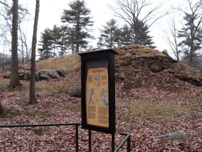
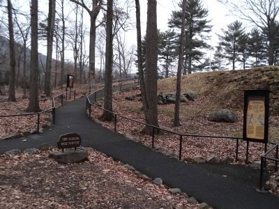
Location. 41° 19.162′ N, 73° 59.37′ W. Marker is in Bear Mountain, New York, in Rockland County. Marker can be reached from Route 9 W, on the right when traveling north. Marker is located on a walking trail through the zoo at Bear Mountain. Touch for map. Marker is in this post office area: Bear Mountain NY 10911, United States of America. Touch for directions.
Other nearby markers. At least 8 other markers are within walking distance of this marker. The West Redoubt of Fort Clinton (a few steps from this marker); Outer Redoubt of Fort Clinton (a few steps from this marker); Fort Clinton’s Outer Redoubt (a few steps from this marker); Appalachian Trail (within shouting distance of this marker); a different marker also named Appalachian Trail (about 300 feet away, measured in a direct line); Fort Clinton (about 300 feet away); The Historic 1777 & 1779 Trails (about 300 feet away); Bear Mountain Bridge (about 400 feet away). Touch for a list and map of all markers in Bear Mountain.
More about this marker. Three battle maps appear on the marker: Burgoyne’s Plan for 1777; General Burgoyne’s Surrender and Sir Henry Clinton’s Attack up the Hudson. Each of these maps shows troop movements, forts and battle sites.
Also see . . . The Battle of Fort's (sic) Montgomery and Clinton. The American Revolutionary War website entry (Submitted on February 16, 2012, by Bill Coughlin of Woodland Park, New Jersey.)
Credits. This page was last revised on August 21, 2021. It was originally submitted on February 16, 2012, by Bill Coughlin of Woodland Park, New Jersey. This page has been viewed 732 times since then and 45 times this year. Photos: 1, 2, 3, 4. submitted on February 16, 2012, by Bill Coughlin of Woodland Park, New Jersey.


