Green Hills in Nashville in Davidson County, Tennessee — The American South (East South Central)
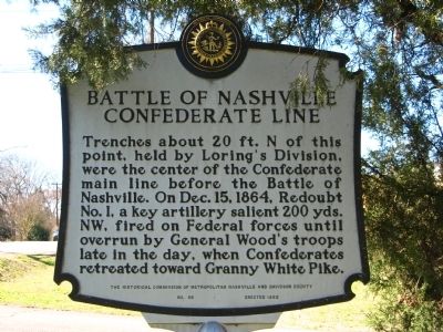
Battle of Nashville Confederate Line
Erected 1992 by The Historical Commission of Metropolitan Nashville and Davidson County. (Marker Number 89.)
Topics and series. This historical marker is listed in this topic list: War, US Civil. In addition, it is included in the Tennessee, The Historical Commission of Metropolitan Nashville and Davidson County series list. A significant historical date for this entry is December 15, 1864.
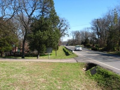
Location. 36° 6.818′ N, 86° 48.355′ W. Marker is in Nashville, Tennessee, in Davidson County. It is in Green Hills. Marker is at the intersection of Woodmont Boulevard and Hopkins Street, on the right when traveling west on Woodmont Boulevard. Located in front of the First Unitarian Universalist Church right beside the drive in for their parking lot. Touch for map. Marker is in this post office area: Nashville TN 37215, United States of America. Touch for directions.
Other nearby markers. At least 8 other markers are within walking distance of this marker. Redoubt One (about 800 feet away, measured in a direct line); Lieutenant General Alexander Peter Stewart (about 800 feet away); Battle of Nashville (approx. 0.4 miles away); Hillsboro High School (approx. 0.6 miles away); Jack Clement Recording Studios (approx. 0.6 miles away); Assault on Montgomery Hill (approx. ¾ mile away); Battle of Nashville Monument (approx. ¾ mile away); a different marker also named Battle of Nashville Monument (approx. ¾ mile away). Touch for a list and map of all markers in Nashville.
Credits. This page was last revised on February 7, 2023. It was originally submitted on February 20, 2012, by Kevin Hoch of Waco, Texas. This page has been viewed 1,267 times since then and 30 times this year. Photos: 1, 2. submitted on February 20, 2012, by Kevin Hoch of Waco, Texas. • Craig Swain was the editor who published this page.

