Philomont in Loudoun County, Virginia — The American South (Mid-Atlantic)
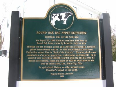
Round Oak Rag Apple Elevation
On August 30, 1965 Elevation was born near here on
Round Oak Farm, owned by Ronald A. Hope & Sons
Through the use of frozen semen and artificial insemination, Elevation
gained international acclaim. In 1999 the Holstein International
Publication named him its "Bull of the Century". Elevation sired a rare
combination of superior production, conformation and longevity. He is
credited with more than 100,000 recorded offspring and has over 8.8
million descendants. Upon his death in 1979 he was buried on the
lawn at Select Sires, Inc., Plain City, Ohio.
In agricultural history, no other animal equals
Elevation's impact on the world.
Erected 2006 by Virginia Holstein Association.
Topics. This historical marker is listed in these topic lists: Animals • Industry & Commerce. A significant historical year for this entry is 1965.
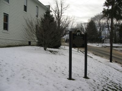
Location. 39° 3.393′ N, 77° 44.421′ W. Marker is in Philomont, Virginia, in Loudoun County. Marker is at the intersection of Snickersville Turnpike (County Route 734) and JEB Stuart Road (County Route 630), on the right when traveling south on Snickersville Turnpike. Touch for map. Marker is in this post office area: Purcellville VA 20132, United States of America. Touch for directions.
Other nearby markers. At least 8 other markers are within 4 miles of this marker, measured as the crow flies. Battle of Unison (here, next to this marker); White Pump Drovers Tavern (approx. 1.4 miles away); Hibbs Bridge (approx. 1.6 miles away); Bacon Fort (approx. 2.2 miles away); a different marker also named The Battle of Unison (approx. 3.1 miles away); Bushrod Lynn (approx. 3.1 miles away); Huntland (approx. 3.2 miles away); a different marker also named Battle of Unison (approx. 3.2 miles away). Touch for a list and map of all markers in Philomont.
Also see . . . Round Oak Rag Apple Elevation. From Loudoun Farm Museum. (Submitted on February 10, 2008, by Craig Swain of Leesburg, Virginia.)
Credits. This page was last revised on April 16, 2022. It was originally submitted on February 10, 2008, by Craig Swain of Leesburg, Virginia. This page has been viewed 3,936 times since then and 78 times this year. Last updated on April 12, 2022, by Carl Gordon Moore Jr. of North East, Maryland. Photos: 1, 2. submitted on February 10, 2008, by Craig Swain of Leesburg, Virginia. • J. Makali Bruton was the editor who published this page.

