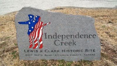
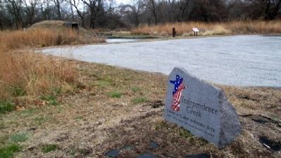
Near Atchison in Atchison County, Kansas — The American Midwest (Upper Plains)
"Grand Village des Canzes"
Atchison County Historic Site
— Lifeways of the Kanza —
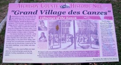
Independence Creek was noted as the main settlement of the Kanza Tribe as far back as 1673. By the time French explorer Etienne Veniard de Bourgmont arrived in 1724 this was considered an old village and the capital of the Kanza nation.
This large village covered the areas all along the Independence Creek valley. From this and other villages the Kanza controlled much of what is today's state of Kansas.
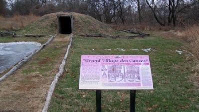
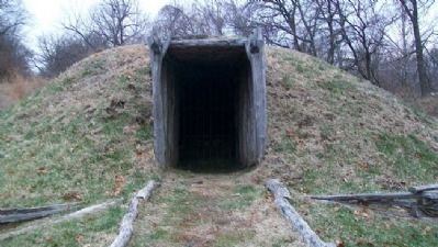
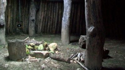
The Kanza dwelling was eclectic, using the most available building materials. Their early migration from the areas near the Great Lakes, in the Ohio River Valley, saw change from primarily bark covered lodges to using sod as the primary covering for the log frame dwellings, since timber was less abundant.
The Kanza also used buffalo and deer skins for constructing tipis used during periodic hunting expeditions to the high plains.
The Creation story of the Kanza
Man and Woman were created by the Great Spirit and the whole of the world was a small island surrounded by leagues and leagues of water.
As time went by children came and the island became so crowded some of the People were forced into the water. Woman prayed to the Great Spirit to have compassion so no more of her children would be lost in the water.
The Great Spirit sent down a large number of beavers, muskrats and turtles whose job it was to gather material from the botom of the water and enlarge the island.
The industrious animals worked until the present Earth was formed. To complete the formation of the Earth the Great Spirit used the colorful dying leaves of fall from the trees along the new rivers to create exotic birds, deer and the buffalo to eat the grass alongside of Indian man and "the entire circle of the earth was filled with life and beauty."
—————
The Kanza lived in semi-permanent villages, cultivating crops and also practicing the nomadic lifestyle of other Great Plains Tribes to hunt buffalo. Buffalo was the Kanza's primary so important was buffalo the entire tribe made two hunting trips to the hunting grounds each year. The principal crops grown by the Kanza were beans, pumpkins, prairie potatoes, melons and corn. Corn was often roasted on the cob or cooked in a soup with strips of buffalo meat. Fish, fowl and dog meat were also important food sources for the Kanza.
—————
[Illustration captions read]
Man of Good Sense, young Kanza warrior, and the Wife of Bear Catcher, both as painted by George Catlin, 1831.
The earliest known image of the interior of a Kanza lodge, a war dance as seen by Samuel Seymour, 1819.
—————
To learn more
about the Kanza also visit the Atchison County Historical Society Museum, in the Santa Fe Depot, 200 S. 10th Street, Atchison, KS or visit online at www.atchisonhistory.org
Erected by Atchison County Historical Society, National Park Service, and Atchison Sertoma Club.
Topics. This historical marker is listed in this topic list: Native Americans. A significant historical year for this entry is 1673.
Location. 39° 37.245′ N, 95° 5.931′ W. Marker is near Atchison, Kansas, in Atchison County. Marker is at Independence Creek Lewis & Clark Historic Site. Touch for map. Marker is at or near this postal address: 19917 314th Road, Atchison KS 66002, United States of America. Touch for directions.
Other nearby markers. At least 8 other markers are within 4 miles of this marker, measured as the crow flies. "this day being…the 4th of July" (about 300 feet away, measured in a direct line); Samuel T. Carpenter (approx. 2.4 miles away); Lincoln School (approx. 3.6 miles away); B. P. Waggener House (approx. 3.6 miles away); Webster Wirt Hetherington House (approx. 3.7 miles away); Muchnic House (approx. 3.7 miles away); Lincoln Address (approx. 3.9 miles away); Atchison County Courthouse (approx. 3.9 miles away). Touch for a list and map of all markers in Atchison.
Also see . . . The Kaw (Kanza) Nation. (Submitted on February 26, 2012, by William Fischer, Jr. of Scranton, Pennsylvania.)
Credits. This page was last revised on June 16, 2016. It was originally submitted on February 26, 2012, by William Fischer, Jr. of Scranton, Pennsylvania. This page has been viewed 1,015 times since then and 22 times this year. Photos: 1, 2, 3, 4, 5, 6. submitted on February 26, 2012, by William Fischer, Jr. of Scranton, Pennsylvania.
