Defiance in Defiance County, Ohio — The American Midwest (Great Lakes)
Defiance Historic Sites
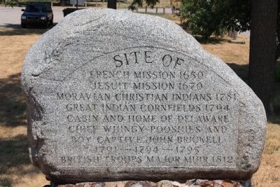
French Mission 1650
Jesuit Mission 1670
Moravian Christian Indians 1781
Great Indian Cornfields 1794
Cabin and Home of Delaware
Chief Whingy-Pooshies and
Boy Captive, John Brickell
1791 - 1794 - 1795
British Troops Major Muir 1812
Topics. This historical marker is listed in these topic lists: Colonial Era • Native Americans • War of 1812 • Wars, US Indian. A significant historical year for this entry is 1650.
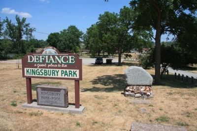
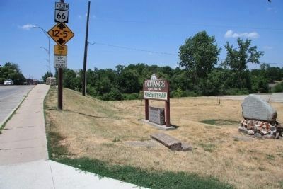
Location. 41° 17.089′ N, 84° 21.384′ W. Marker is in Defiance, Ohio, in Defiance County. Marker is on East 2nd Street (Ohio Route 66) near Auglaize Street, on the right when traveling west. This historical marker is actually a large stone or boulder that has had much historical information carved on its one side. The historical marker is sitting at the front entrance (on the left hand side) to Kingsbury Park, just off of East 2nd Street. The park is located on the eastern side of the Auglaize River at this river's juncture with the Maumee River. Touch for map. Marker is in this post office area: Defiance OH 43512, United States of America. Touch for directions.
Other nearby markers. At least 8 other markers are within walking distance of this marker. Fort Winchester (about 600 feet away, measured in a direct line); a different marker also named Fort Winchester (about 600 feet away); Fort Winchester - Former Site Of North East Blockhouse (about 700 feet away); Fort Winchester - Former Site Of South East Blockhouse (about 700 feet away); Location Of The Powder Magazine (approx. 0.2 miles away); Location Of The Officers Quarters (approx. 0.2 miles away); East Blockhouse (approx. 0.2 miles away); a different marker also named Fort Winchester (approx. 0.2 miles away). Touch for a list and map of all markers in Defiance.
Credits. This page was last revised on February 2, 2021. It was originally submitted on February 26, 2012, by Dale K. Benington of Toledo, Ohio. This page has been viewed 1,161 times since then and 32 times this year. Last updated on January 29, 2021, by Craig Doda of Napoleon, Ohio. Photos: 1, 2, 3. submitted on February 26, 2012, by Dale K. Benington of Toledo, Ohio. 4. submitted on January 29, 2021, by Craig Doda of Napoleon, Ohio. • J. Makali Bruton was the editor who published this page.


