Manheim in Lancaster County, Pennsylvania — The American Northeast (Mid-Atlantic)
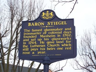
Baron Stiegel
Erected 1947 by Pennsylvania Historical and Museum Commission.
Topics and series. This historical marker is listed in these topic lists: Arts, Letters, Music • Churches & Religion • Colonial Era • Industry & Commerce • Settlements & Settlers. In addition, it is included in the Pennsylvania Historical and Museum Commission series list. A significant historical year for this entry is 1762.
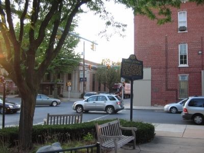
Location. 40° 9.828′ N, 76° 23.701′ W. Marker is in Manheim, Pennsylvania, in Lancaster County. Marker is on N. Main Street, on the right when traveling north. Marker is in the park at the town square. Touch for map. Marker is at or near this postal address: High Street, Manheim PA 17545, United States of America. Touch for directions.
Other nearby markers. At least 8 other markers are within walking distance of this marker. Henry William Steigel / Henry M Muhlenberg / Robert Morris (a few steps from this marker); Manheim Veterans Memorial (within shouting distance of this marker); Heintzelman House (about 300 feet away, measured in a direct line); Memorial to Henry William Stiegel (about 300 feet away); Manheim Historical Society (about 400 feet away); Stiegel Glass Manufactory (approx. 0.4 miles away); a different marker also named Manheim Veterans Memorial (approx. 0.4 miles away); Shearer's Covered Bridge (approx. 0.6 miles away). Touch for a list and map of all markers in Manheim.
Credits. This page was last revised on December 7, 2019. It was originally submitted on February 11, 2008, by Bill Pfingsten of Bel Air, Maryland. This page has been viewed 1,460 times since then and 15 times this year. Photos: 1. submitted on February 11, 2008, by Bill Pfingsten of Bel Air, Maryland. 2. submitted on October 13, 2008, by Craig Swain of Leesburg, Virginia.

