Lancaster Township in Lancaster County, Pennsylvania — The American Northeast (Mid-Atlantic)
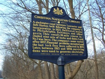
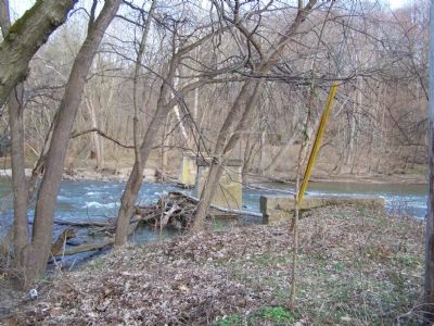
Conestoga Navigation Company
Erected 2001 by Pennsylvania Historical and Museum Commission.
Topics and series. This historical marker is listed in these topic lists: Industry & Commerce • Waterways & Vessels. In addition, it is included in the Pennsylvania Historical and Museum Commission series list. A significant historical year for this entry is 1825.
Location. 40° 0.614′ N, 76° 18.222′ W. Marker is near Lancaster, Pennsylvania, in Lancaster County. It is in Lancaster Township. Marker is on New Danville Pike, 0.3 miles south of 2nd Lock Road, on the left when traveling south. Touch for map. Marker is at or near this postal address: 1370 New Danville Pike, Lancaster PA 17603, United States of America. Touch for directions.
Other nearby markers. At least 8 other markers are within 2 miles of this marker, measured as the crow flies. Rock Ford (approx. 1.1 miles away); Kurtz's Mill Covered Bridge (approx. 1.2 miles away); Stevens Greenland Cemetery (approx. 1.3 miles away); Frederick Augustus Muhlenberg (approx. 1.3 miles away); Gotthilf Heinrich Ernst Muhlenberg, S.T.B. (approx. 1.3 miles away); James Buchanan (approx. 1.3 miles away); a different marker also named Stevens Greenland Cemetery (approx. 1.4 miles away); At Rockford near here lived & died General Edward Hand, M.D. (approx. 1.4 miles away). Touch for a list and map of all markers in Lancaster.
Credits. This page was last revised on February 7, 2023. It was originally submitted on February 11, 2008, by Bill Pfingsten of Bel Air, Maryland. This page has been viewed 2,075 times since then and 33 times this year. Photos: 1, 2. submitted on February 11, 2008, by Bill Pfingsten of Bel Air, Maryland.

