Groveland in Tuolumne County, California — The American West (Pacific Coastal)
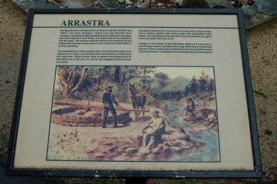
Arrastra
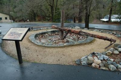
The simplest form of the arrastra was a flat-bottomed drag stone place in a circular, rock-lined pit and connected to a center post by a long arm. With a horse, mule or person provided power at the other end of the arm, the stone dragged slowly around in a circle.
Ore place between the stone floor and drag stone was crushed into a coarse powder after which water and quicksilver were added. The resulting slurry was removed to sluices (troughs) were the gold was recovered.
Thanks to the efforts of the Stanislaus National Forest Groveland Ranger District, the title to the drag stone and all of the floor stones of this arrastra was transferred to the Groveland Yosemite Gateway Museum. It has been reconstructed by local volunteers.
Topics. This historical marker is listed in these topic lists: Industry & Commerce • Natural Resources.
Location. 37° 50.388′ N, 120° 13.568′ W. Marker is in Groveland, California, in Tuolumne County. Marker is on Main Street (State Highway 120), on the right when traveling west. This marker is located near the Groveland Library/Museum. Touch for map. Marker is at or near this postal address: 18990 Main Street, Groveland CA 95321, United States of America. Touch for directions.
Other nearby markers. At least 8 other markers are within 7 miles of this marker, measured as the crow flies. Groveland Hotel (approx. 0.2 miles away); Iron Door Saloon (approx. 0.2 miles away); Groveland (approx. 0.2 miles away); Second Garrote (approx. 2 miles away); Joseph E. Lemos (approx. 2.1 miles away); Big Oak Flat (approx. 2.2 miles away); Ferretti Shrine (approx. 5.3 miles away); Stevens Bar Bridge (approx. 6.6 miles away). Touch for a list and map of all markers in Groveland.
Credits. This page was last revised on June 16, 2016. It was originally submitted on March 7, 2012, by Barry Swackhamer of Brentwood, California. This page has been viewed 616 times since then and 21 times this year. Photos: 1, 2. submitted on March 7, 2012, by Barry Swackhamer of Brentwood, California. • Syd Whittle was the editor who published this page.

