Burton Valley in Nashville in Davidson County, Tennessee — The American South (East South Central)
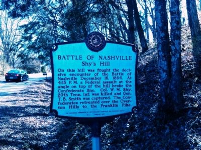
Battle of Nashville
Shy's Hill
Erected 1967 by The Historical Commission of Metropolitan Nashville and Davidson County. (Marker Number 5.)
Topics and series. This historical marker is listed in this topic list: War, US Civil. In addition, it is included in the Tennessee, The Historical Commission of Metropolitan Nashville and Davidson County series list. A significant historical date for this entry is December 16, 1763.
Location. 36° 5.269′ N, 86° 48.481′ W. Marker is in Nashville, Tennessee, in Davidson County. It is in Burton Valley. Marker is on Benton Smith Road, on the right when traveling south. Touch for map. Marker is in this post office area: Nashville TN 37215, United States of America. Touch for directions.
Other nearby markers. At least 8 other markers are within one mile of this marker, measured as the crow flies. Minnesota (within shouting distance of this marker); a different marker also named Battle of Nashville (approx. ¼ mile away); a different marker also named Battle of Nashville (approx. ¼ mile away); Dry-Stack Stone Walls (approx. ¼ mile away); Josephine Groves Holloway / Girl Scouts of Middle Tennessee (approx. 0.3 miles away); John Trotwood Moore (approx. 0.6 miles away); Monroe Harding (approx. 0.8 miles away); Granny White Grave (approx. one mile away). Touch for a list and map of all markers in Nashville.
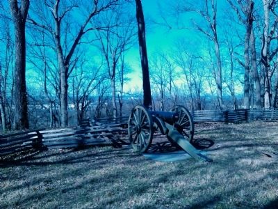
More about this marker. The marker is at the base of a short trail that takes you up to the top of Shy's Hill.
Credits. This page was last revised on February 7, 2023. It was originally submitted on March 10, 2012, by Kevin Hoch of Waco, Texas. This page has been viewed 1,124 times since then and 25 times this year. Photos: 1, 2, 3, 4, 5, 6, 7. submitted on March 11, 2012, by Kevin Hoch of Waco, Texas. • Craig Swain was the editor who published this page.


